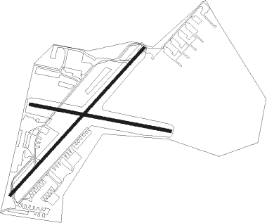
Dairy Flat - North Shore
Airport details
| Country | New Zealand |
| State | Auckland |
| Region | NZ |
| Municipality | Rodney |
| Elevation | 210ft (64m) |
| Timezone | GMT +13 |
| Coordinates | -36.65651, 174.65401 |
| Magnetic var | |
| Type | land |
| Available since | X-Plane v10.40 |
| ICAO code | NZNE |
| IATA code | n/a |
| FAA code | n/a |
Communication
Nearby Points of Interest:
Gluepot Tavern
-Dilworth Building
-Auckland volcanic field
-Bluestone Store
-Kenneth Myers Centre
-Auckland Savings Bank Building
-Auckland Town Hall
-Albert Barracks Wall
-Stoneways
-Chapel of St John the Evangelist, Auckland
-Pah Homestead
-Smelting House ruins

Nearby beacons
| code | identifier | dist | bearing | frequency |
|---|---|---|---|---|
| WP | WHENUAPAI (AUCKLAND) VOR/DME | 7.9 | 190° | 116.40 |
| AA | AUCKLAND VOR/DME | 22.2 | 155° | 114.80 |
| WI | WAIUKU NDB | 37.4 | 165° | 254 |
| SY | SURREY NDB | 42.7 | 139° | 350 |
| SF | SPRINGFIELD (WHANGAREI) NDB | 48.4 | 339° | 366 |
| WR | WHANGAREI NDB | 54.9 | 342° | 326 |
| WR | DME | 55 | 342° | 117.30 |
Departure and arrival routes
| Transition altitude | 13000ft |
| Transition level | 15000ft |
| STAR starting points | distance | inbound heading | |
|---|---|---|---|
| RW21 | |||
| DOST1A | 46.2 | 243° | |
Instrument approach procedures
| runway | airway (heading) | route (dist, bearing) |
|---|---|---|
| RW03 | LIBKO (77°) | LIBKO 2000ft |
| RW03 | PANGO (104°) | PANGO LIBKO (5mi, 164°) 2000ft |
| RNAV | LIBKO 2000ft RIKDI (4mi, 83°) 1400ft MA03 (3mi, 75°) 494ft UPLIN (11mi, 53°) 2100ft UPLIN (turn) 2100ft | |
| RW21 | BOLOR (206°) | BOLOR UPLIN (5mi, 131°) 2100ft |
| RW21 | UPLIN (233°) | UPLIN 2100ft |
| RNAV | UPLIN 2100ft FF21 (5mi, 233°) 2080ft MA21 (5mi, 233°) 276ft LIBKO (8mi, 256°) 2000ft LIBKO (turn) 2000ft |
Disclaimer
The information on this website is not for real aviation. Use this data with the X-Plane flight simulator only! Data taken with kind consent from X-Plane 12 source code and data files. Content is subject to change without notice.