Napier
Airport details
| Country | New Zealand |
| State | Hawke's Bay |
| Region | NZ |
| Municipality | Napier |
| Elevation | 3ft (1m) |
| Timezone | GMT +12 |
| Coordinates | -39.46583, 176.87000 |
| Magnetic var | |
| Type | land |
| Available since | X-Plane v10.40 |
| ICAO code | NZNR |
| IATA code | NPE |
| FAA code | n/a |
Communication
| Napier ATIS | 121.800 |
| Napier CTAF | 118.100 |
| Napier Tower | 118.100 |
| Napier Tower | 124.800 |
| Napier Approach | 124.800 |
| Napier Approach | 118.100 |
Nearby Points of Interest:
Whare Ra
-Mohaka Viaduct
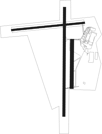
Runway info
Runway 16 / 34  | ||
| length | 1754m (5755ft) | |
| bearing | 186° / 6° | |
| width | 45m (148ft) | |
| surface | asphalt | |
| Runway 07 / 25 | ||
| length | 1196m (3924ft) | |
| bearing | 89° / 269° | |
| width | 30m (98ft) | |
| surface | dirt | |
| Runway 16L / 34R | ||
| length | 753m (2470ft) | |
| bearing | 186° / 6° | |
| width | 60m (198ft) | |
| surface | dirt | |
Nearby beacons
| code | identifier | dist | bearing | frequency |
|---|---|---|---|---|
| NR | NAPIER VOR/DME | 0.7 | 355° | 113.80 |
| AP | TAUPO NDB | 57 | 312° | 230 |
Departure and arrival routes
| Transition altitude | 13000ft |
| Transition level | 15000ft |
| SID end points | distance | outbound heading | |
|---|---|---|---|
| RW16 | |||
| LEDIV2 | 30mi | 250° | |
| 16LIM3 | 35mi | 266° | |
| MOOSE1 | 37mi | 338° | |
| RW34 | |||
| OBLOX2 | 30mi | 250° | |
| 34LIM3 | 37mi | 338° | |
| STAR starting points | distance | inbound heading | |
|---|---|---|---|
| RW16 | |||
| OPAP2A | 21.3 | 29° | |
| ADGI1A | 21.4 | 48° | |
| YARO2A | 21.5 | 56° | |
| GEND1A | 22.5 | 133° | |
| MOKE1A | 18.7 | 158° | |
| RW34 | |||
| OPAP1B | 21.3 | 29° | |
| ADGI1B | 21.4 | 48° | |
| YARO2B | 21.5 | 56° | |
| GEND2B | 22.5 | 133° | |
| MOKE1B | 18.7 | 158° | |
Instrument approach procedures
| runway | airway (heading) | route (dist, bearing) |
|---|---|---|
| RW16 | AROPA (210°) | AROPA 4200ft |
| RW16 | ELBOW (179°) | ELBOW AROPA (5mi, 111°) 2900ft |
| RW16 | NANUA (236°) | NANUA AROPA (5mi, 291°) 2900ft |
| RNAV | AROPA 2900ft FF16 (5mi, 213°) 1810ft MA16 (5mi, 213°) 284ft PANIA (10mi, 92°) 2700ft PANIA (turn) 2700ft | |
| RW34 | AKINA (7°) | AKINA 3300ft |
| RW34 | MILLA (331°) | MILLA AKINA (5mi, 274°) 2000ft |
| RW34 | OHITI (41°) | OHITI AKINA (5mi, 94°) 2000ft |
| RNAV | AKINA 2000ft FF34 (5mi, 6°) 1190ft NZNR (4mi, 8°) 55ft (8434mi, 283°) 600ft PANIA (8435mi, 103°) 2700ft PANIA (turn) 2700ft |
Disclaimer
The information on this website is not for real aviation. Use this data with the X-Plane flight simulator only! Data taken with kind consent from X-Plane 12 source code and data files. Content is subject to change without notice.