Nelson
Airport details
| Country | New Zealand |
| State | Nelson |
| Region | NZ |
| Elevation | 16ft (5m) |
| Timezone | GMT +12 |
| Coordinates | -41.29607, 173.22830 |
| Magnetic var | |
| Type | land |
| Available since | X-Plane v10.40 |
| ICAO code | NZNS |
| IATA code | NSN |
| FAA code | n/a |
Communication
| Nelson NZNS ATIS | 129.100 |
| Nelson NELSON CLD | 123.300 |
| Nelson NELSON Tower | 127.400 |
| Nelson NELSON Approach | 127.400 |
Nearby Points of Interest:
Stafford Place
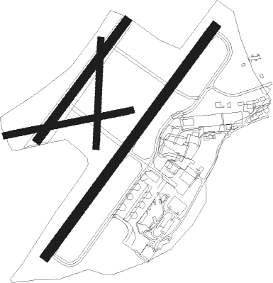
Runway info
Runway 02 / 20  | ||
| length | 1355m (4446ft) | |
| bearing | 49° / 229° | |
| width | 45m (148ft) | |
| surface | asphalt | |
| Runway 06 / 24 | ||
| length | 607m (1991ft) | |
| bearing | 85° / 265° | |
| width | 30m (98ft) | |
| surface | grass | |
| Runway 17 / 35 | ||
| length | 507m (1663ft) | |
| bearing | 189° / 9° | |
| width | 30m (98ft) | |
| surface | grass | |
| Runway 02L / 20R | ||
| length | 700m (2297ft) | |
| bearing | 49° / 229° | |
| width | 40m (131ft) | |
| surface | grass | |
Nearby beacons
| code | identifier | dist | bearing | frequency |
|---|---|---|---|---|
| NS | NELSON VOR/DME | 0.7 | 238° | 113.10 |
| WB | WOODBOURNE VOR/DME | 31.5 | 109° | 115.60 |
| BM | DME | 38.3 | 105° | 117.90 |
Departure and arrival routes
| Transition altitude | 13000ft |
| Transition level | 15000ft |
| SID end points | distance | outbound heading | |
|---|---|---|---|
| RW02 | |||
| LEMU2P | 30mi | 42° | |
| LUSR2R, LUSR2P | 28mi | 92° | |
| IDNI2P | 30mi | 225° | |
| DUMI1P | 15mi | 328° | |
| RW20 | |||
| PAVN2Q, VICTO2 | 30mi | 42° | |
| LUSR2S, LUSR3U, LUSR2Q | 28mi | 92° | |
| BISE1Q | 30mi | 198° | |
| NEST1Q | 30mi | 225° | |
| CONO1Q | 28mi | 254° | |
| DUMI2Q | 15mi | 328° | |
| STAR starting points | distance | inbound heading | |
|---|---|---|---|
| RW02 | |||
| BISE2A | 29.6 | 18° | |
| CONO1A | 28.3 | 74° | |
| KAPU2A | 15.4 | 183° | |
| GUSD2A | 22.6 | 246° | |
| LUBS2A, LUBS2C | 23.2 | 290° | |
| RW20 | |||
| GUNE1B | 20.6 | 19° | |
| CONO1B | 28.3 | 74° | |
| MUKR1B | 21.2 | 178° | |
| KUNV1B | 29.4 | 203° | |
| GUSD1B | 22.6 | 246° | |
| LUBS1B | 23.2 | 290° | |
Instrument approach procedures
| runway | airway (heading) | route (dist, bearing) |
|---|---|---|
| RW02-Y | MIBEV (76°) | MIBEV OTLIT (5mi, 141°) 3900ft |
| RW02-Y | QUAIL (45°) | QUAIL OTLIT (5mi, 325°) 4900ft |
| RNAV | OTLIT 3900ft ISLOP (9mi, 65°) 1970ft PATRU (5mi, 56°) 490ft BURMO (10mi, 1°) MUKRA (13mi, 4°) 4000ft MUKRA (turn) 4000ft | |
| RW02-Z | ESNED (79°) | ESNED TUMGO (5mi, 141°) 3600ft |
| RNAV | TUMGO 3300ft ISLOP (5mi, 65°) 1970ft PATRU (5mi, 56°) 490ft BURMO (10mi, 1°) MUKRA (13mi, 4°) 4000ft MUKRA (turn) 4000ft | |
| RWNVB | ELMAX (207°) | ELMAX 3500ft |
| RWNVB | KAPUA (183°) | KAPUA ELMAX (5mi, 109°) 3500ft |
| RWNVB | LIKMA (227°) | LIKMA ELMAX (5mi, 276°) 3500ft |
| RNAV | ELMAX 3500ft NOPEM (4mi, 207°) 3150ft ORUBA (9mi, 208°) 256ft DOTPI (5mi, 280°) PAVNI (17mi, 0°) MUKRA (5mi, 70°) 4000ft MUKRA (turn) 4000ft |
Holding patterns
| STAR name | hold at | type | turn | heading* | altitude | leg | speed limit |
|---|---|---|---|---|---|---|---|
| BISE2A | BISEB | VHF | right | 146 (326)° | > 9200ft | 1.0min timed | 210 |
| CONO1B | NS | NDB | left | 158 (338)° | > 8000ft | DME 4.0mi | 210 |
| GUNE1B | GUNEL | VHF | right | 171 (351)° | > 9100ft | DME 4.0mi | ICAO rules |
| GUNE1B | NS | NDB | left | 158 (338)° | > 8000ft | DME 4.0mi | 210 |
| GUSD1B | GUSDU | VHF | right | 76 (256)° | > 5500ft | 1.0min timed | 210 |
| GUSD2A | GUSDU | VHF | right | 76 (256)° | > 5500ft | 1.0min timed | 210 |
| KAPU2A | KAPUA | VHF | right | 11 (191)° | > 2900ft | 1.0min timed | 200 |
| KAPU2A | MUKRA | VHF | right | 330 (150)° | > 3100ft | 1.0min timed | 190 |
| KUNV1B | ELMAX | VHF | right | 360 (180)° | > 4000ft | DME 5.0mi | ICAO rules |
| LUBS1B | NS | NDB | left | 158 (338)° | > 8000ft | DME 4.0mi | 210 |
| LUBS2A | NS | NDB | left | 158 (338)° | > 8000ft | DME 4.0mi | 210 |
| LUBS2C | LERTI | VHF | right | 337 (157)° | > 7800ft | 1.0min timed | 210 |
| MUKR1B | MUKRA | VHF | right | 330 (150)° | > 3100ft | 1.0min timed | 190 |
| *) magnetic outbound (inbound) holding course | |||||||
Disclaimer
The information on this website is not for real aviation. Use this data with the X-Plane flight simulator only! Data taken with kind consent from X-Plane 12 source code and data files. Content is subject to change without notice.