Invercargill
Airport details
| Country | New Zealand |
| State | Southland |
| Region | NZ |
| Municipality | Invercargill City |
| Elevation | 15ft (5m) |
| Timezone | GMT +12 |
| Coordinates | -46.41500, 168.32001 |
| Magnetic var | |
| Type | land |
| Available since | X-Plane v10.40 |
| ICAO code | NZNV |
| IATA code | IVC |
| FAA code | n/a |
Communication
| Invercargill ATIS | 127.000 |
| Invercargill CTAF | 118.500 |
| Invercargill Tower | 118.500 |
| Invercargill Tower | 122.400 |
| Invercargill Approach | 122.400 |
| Invercargill Approach | 118.500 |
Nearby Points of Interest:
St. Mary's Basilica
-Howell's Cottage
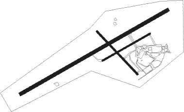
Runway info
Runway 04 / 22  | ||
| length | 2208m (7244ft) | |
| bearing | 72° / 252° | |
| width | 45m (148ft) | |
| surface | asphalt | |
| displ threshold | 130m (427ft) / 172m (564ft) | |
| Runway 12 / 30 | ||
| length | 769m (2523ft) | |
| bearing | 130° / 310° | |
| width | 25m (82ft) | |
| surface | grass | |
| Runway 04R / 22L | ||
| length | 709m (2326ft) | |
| bearing | 72° / 252° | |
| width | 20m (66ft) | |
| surface | grass | |
Nearby beacons
| code | identifier | dist | bearing | frequency |
|---|---|---|---|---|
| NV | INVERCARGILL VOR/DME | 0.2 | 325° | 116.80 |
Departure and arrival routes
| Transition altitude | 13000ft |
| Transition level | 15000ft |
| SID end points | distance | outbound heading | |
|---|---|---|---|
| RW04 | |||
| ANOP2P | 59mi | 18° | |
| INTU1P | 30mi | 43° | |
| ADLU2P | 89mi | 56° | |
| EPDA2P | 20mi | 88° | |
| AMVI2P | 12mi | 165° | |
| PEXE1P | 30mi | 327° | |
| RW22 | |||
| ANOP2Q | 59mi | 18° | |
| INTU1Q | 30mi | 43° | |
| ADLU2Q | 89mi | 56° | |
| EPDA4Q | 20mi | 88° | |
| AMVI2Q | 12mi | 165° | |
| PEXE1Q | 30mi | 327° | |
| STAR starting points | distance | inbound heading | |
|---|---|---|---|
| RW04 | |||
| PEXE1A | 30.1 | 147° | |
| ANOP4A | 20.1 | 198° | |
| DUKO4A | 89.5 | 240° | |
| AKPI3A | 51.8 | 254° | |
| AMVI1A | 11.8 | 345° | |
| RW22 | |||
| ANOP5B | 20.1 | 198° | |
| DUKO5B | 89.5 | 240° | |
| AKPI3B | 51.8 | 254° | |
| AMVI2B | 11.8 | 345° | |
Instrument approach procedures
| runway | airway (heading) | route (dist, bearing) |
|---|---|---|
| RW04 | EGAMU (52°) | EGAMU KAGRU (4mi, 326°) 2000ft |
| RW04 | ESNUP (90°) | ESNUP KAGRU (4mi, 146°) 2000ft |
| RNAV | KAGRU 2000ft NILIB (4mi, 72°) 1330ft NZNV (5mi, 73°) 55ft NV404 (3mi, 70°) AMVIX (13mi, 185°) 3000ft AMVIX (turn) 3000ft | |
| RW22 | DOTLU (270°) | DOTLU DUNAX (4mi, 326°) 2000ft |
| RW22 | LALEV (218°) | LALEV DUNAX (8mi, 165°) 2000ft |
| RNAV | DUNAX 2000ft PALTU (4mi, 252°) 1330ft NZNV (4mi, 251°) 54ft NV422 (4mi, 253°) AMVIX (12mi, 141°) 3000ft AMVIX (turn) 3000ft |
Holding patterns
| STAR name | hold at | type | turn | heading* | altitude | leg | speed limit |
|---|---|---|---|---|---|---|---|
| AKPI3A | BIDKU | VHF | left | 42 (222)° | > 3000ft | 1.0min timed | 210 |
| AKPI3A | EGAMU | VHF | left | 129 (309)° | > 2500ft | 1.0min timed | ICAO rules |
| AKPI3B | BIDKU | VHF | left | 42 (222)° | > 3000ft | 1.0min timed | 210 |
| AMVI1A | AMVIX | VHF | left | 92 (272)° | > 2000ft | 1.0min timed | ICAO rules |
| AMVI1A | EGAMU | VHF | left | 129 (309)° | > 2500ft | 1.0min timed | ICAO rules |
| AMVI2B | AMVIX | VHF | left | 92 (272)° | > 2000ft | 1.0min timed | ICAO rules |
| ANOP4A | ANOPA | VHF | left | 348 (168)° | > 4600ft | 1.0min timed | ICAO rules |
| ANOP5B | ANOPA | VHF | left | 348 (168)° | > 4600ft | 1.0min timed | ICAO rules |
| DUKO4A | BIDKU | VHF | left | 42 (222)° | > 3000ft | 1.0min timed | 210 |
| DUKO4A | EGAMU | VHF | left | 129 (309)° | > 2500ft | 1.0min timed | ICAO rules |
| DUKO5B | BIDKU | VHF | left | 42 (222)° | > 3000ft | 1.0min timed | 210 |
| *) magnetic outbound (inbound) holding course | |||||||
Disclaimer
The information on this website is not for real aviation. Use this data with the X-Plane flight simulator only! Data taken with kind consent from X-Plane 12 source code and data files. Content is subject to change without notice.