Ohakea
Airport details
| Country | New Zealand |
| State | Manawatū-Whanganui |
| Region | NZ |
| Municipality | Manawatū District |
| Elevation | 164ft (50m) |
| Timezone | GMT +12 |
| Coordinates | -40.19959, 175.37581 |
| Magnetic var | |
| Type | land |
| Available since | X-Plane v10.40 |
| ICAO code | NZOH |
| IATA code | OHA |
| FAA code | n/a |
Communication
| Ohakea ATIS | 135.000 |
| Ohakea CTAF | 134.500 |
| Ohakea Ground Control | 122.100 |
| Ohakea Tower | 134.500 |
| Ohakea Approach | 128.500 |
| Ohakea Approach | 123.200 |
| Ohakea Approach | 125.100 |
Approach frequencies
| ILS-cat-I | RW27 | 111.1 | 18.00mi |
| ILS-cat-I | RW09 | 110.7 | 18.00mi |
| 3° GS | RW27 | 111.1 | 18.00mi |
| 3° GS | RW09 | 110.7 | 18.00mi |
Nearby Points of Interest:
Caccia Birch House
-Cameron Blockhouse
-Durie Hill Elevator
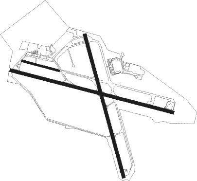
Runway info
Runway 09 / 27  | ||
| length | 2440m (8005ft) | |
| bearing | 105° / 285° | |
| width | 45m (148ft) | |
| surface | asphalt | |
| displ threshold | 148m (486ft) / 0m (0ft) | |
| Runway 15 / 33 | ||
| length | 2142m (7028ft) | |
| bearing | 166° / 346° | |
| width | 48m (157ft) | |
| surface | asphalt | |
| blast zone | 0m (0ft) / 3m (10ft) | |
| Runway 09L / 27R | ||
| length | 551m (1808ft) | |
| bearing | 105° / 285° | |
| width | 27m (89ft) | |
| surface | grass | |
Nearby beacons
| code | identifier | dist | bearing | frequency |
|---|---|---|---|---|
| OH | OHAKEA VOR/DME | 0.9 | 122° | 117.10 |
| PM | PALMERSTON NORTH VOR/DME | 14 | 115° | 113.40 |
| WU | WHANGANUI NDB | 21.5 | 305° | 382 |
| WU | DME | 21.6 | 305° | 116 |
| PP | PARAPARAUMU NDB | 45.8 | 209° | 242 |
Departure and arrival routes
| Transition altitude | 13000ft |
| Transition level | 15000ft |
| SID end points | distance | outbound heading | |
|---|---|---|---|
| RW09 | |||
| DANP2Q | 26mi | 221° | |
| RW27 | |||
| ENGO2P | 26mi | 221° | |
| STAR starting points | distance | inbound heading | |
|---|---|---|---|
| RW09 | |||
| BINI1H | 26.1 | 28° | |
| IDLU1H | 24.1 | 206° | |
| RW27 | |||
| BINI1G | 26.1 | 28° | |
| IDLU1G | 24.1 | 206° | |
Instrument approach procedures
| runway | airway (heading) | route (dist, bearing) |
|---|---|---|
| RW09 | BOBIT (131°) | BOBIT NUTGO (5mi, 204°) 2500ft |
| RW09 | DOTGO (83°) | DOTGO NUTGO (4mi, 24°) 2500ft |
| RW09 | LELUK (104°) | LELUK NUTGO (3mi, 105°) 2500ft |
| RNAV | NUTGO 2500ft NIVOD (4mi, 105°) 1470ft NZOH (4mi, 103°) 200ft (8383mi, 283°) 1200ft ENDIX (8385mi, 103°) 5000ft ENDIX (turn) | |
| RW15 | ADKIS (183°) | ADKIS GUPIL (4mi, 207°) 2500ft |
| RW15 | BOBIT (131°) | BOBIT GUPIL (5mi, 82°) 2500ft |
| RNAV | GUPIL 2500ft DOXIN (4mi, 166°) 1490ft NZOH (4mi, 174°) 214ft ENDIX (12mi, 86°) 5000ft ENDIX (turn) | |
| RW27-Y | ENDIX (266°) | ENDIX SAKOG (4mi, 240°) 2500ft |
| RNAV | SAKOG 2500ft PEDBA (4mi, 261°) 1470ft NZOH (5mi, 286°) 199ft (8383mi, 283°) 1200ft MABEK (8393mi, 103°) 4000ft MABEK (turn) | |
| RW33 | NOBED (344°) | NOBED SOSLA (7mi, 346°) 2500ft |
| RW33 | VARNO (13°) | VARNO SOSLA (4mi, 82°) 2500ft |
| RNAV | SOSLA 2500ft VELSU (4mi, 346°) 1460ft NZOH (5mi, 339°) 182ft (8383mi, 283°) 1200ft MABEK (8393mi, 103°) 4000ft MABEK (turn) |
Holding patterns
| STAR name | hold at | type | turn | heading* | altitude | leg | speed limit |
|---|---|---|---|---|---|---|---|
| BINI1G | AVGUV | VHF | left | 245 (65)° | > 5100ft | 1.0min timed | 220 |
| IDLU1G | ENDIX | VHF | right | 31 (211)° | > 5000ft | 1.0min timed | 210 |
| *) magnetic outbound (inbound) holding course | |||||||
Disclaimer
The information on this website is not for real aviation. Use this data with the X-Plane flight simulator only! Data taken with kind consent from X-Plane 12 source code and data files. Content is subject to change without notice.