Paraparaumu - Paraparaumu (kapiti Coast)
Airport details
| Country | New Zealand |
| State | Wellington |
| Region | NZ |
| Municipality | Kapiti Coast District |
| Elevation | 20ft (6m) |
| Timezone | GMT +12 |
| Coordinates | -40.90289, 174.98561 |
| Magnetic var | |
| Type | land |
| Available since | X-Plane v10.40 |
| ICAO code | NZPP |
| IATA code | PPQ |
| FAA code | n/a |
Communication
| Paraparaumu (Kapiti Coast) CTAF | 118.300 |
| Paraparaumu (Kapiti Coast) WELLINGTON Approach | 122.300 |
| Paraparaumu (Kapiti Coast) WELLINGTON Approach | 119.300 |
| Paraparaumu (Kapiti Coast) WELLINGTON Approach | 126.500 |
| Paraparaumu (Kapiti Coast) WELLINGTON Approach | 121.100 |
Nearby Points of Interest:
Taylor-Stace Cottage
-The Glebe
-Lower Hutt Central Fire Station
-Carkeek Observatory
-Daisy Hill Farm House
-Featherston Prisoner of War Camp
-Longwood
-Chew Cottage
-New Zealand Parliamentary Library
-Parliament House, Wellington
-New Zealand Parliament Buildings
-Beehive
-Old Government Buildings, Wellington
-Public Trust Building
-Defence House
-Wellesley Club Building
-Dominion Farmers' Institute
-Wellington Harbour Board Wharf Office Building
-Former Australian Temperance and General Mutual Life Assurance Society Limited Head Office
-Wellington Harbour Board Head Office and Bond Store
-AMP Society Building
-Karori Crematorium
-Mutual Life & Citizens Assurance Company Building
-Old BNZ Building
-Stewart Dawson's Building
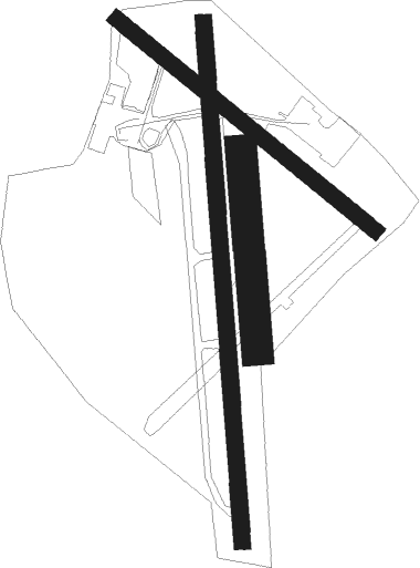
Runway info
Runway 12 / 30  | ||
| length | 898m (2946ft) | |
| bearing | 126° / 306° | |
| width | 42m (138ft) | |
| surface | asphalt | |
| displ threshold | 24m (79ft) / 32m (105ft) | |
| Runway 16 / 34 | ||
| length | 1404m (4606ft) | |
| bearing | 180° / 0° | |
| width | 45m (148ft) | |
| surface | asphalt | |
| displ threshold | 261m (856ft) / 100m (328ft) | |
| blast zone | 54m (177ft) / 0m (0ft) | |
| Runway 16L / 34R | ||
| length | 538m (1765ft) | |
| bearing | 180° / 360° | |
| width | 85m (279ft) | |
| surface | grass | |
Nearby beacons
| code | identifier | dist | bearing | frequency |
|---|---|---|---|---|
| PP | PARAPARAUMU NDB | 0.1 | 267° | 242 |
| NL | NEWLANDS (WELLINGTON) NDB | 20.8 | 206° | 358 |
| WN | WELLINGTON VOR/DME | 27.1 | 201° | 112.30 |
| TR | DME | 32.9 | 246° | 114.60 |
| OH | OHAKEA VOR/DME | 45.5 | 30° | 117.10 |
| PM | PALMERSTON NORTH VOR/DME | 45.9 | 48° | 113.40 |
| BM | DME | 56.2 | 238° | 117.90 |
| WU | WHANGANUI NDB | 56.6 | 2° | 382 |
| WU | DME | 56.7 | 2° | 116 |
Departure and arrival routes
| Transition altitude | 13000ft |
| Transition level | 15000ft |
| SID end points | distance | outbound heading | |
|---|---|---|---|
| RW16 | |||
| AGAXA3 | 15mi | 217° | |
| RW34 | |||
| GUGAK4 | 15mi | 217° | |
| STAR starting points | distance | inbound heading | |
|---|---|---|---|
| RW16 | |||
| AGSO1H | 22.5 | 56° | |
| AVKE1H | 32.9 | 66° | |
| TPAP1H | 26.8 | 110° | |
| KAPT1H | 16.3 | 182° | |
| KAME1H | 15.3 | 210° | |
| RW34 | |||
| AGSO1G | 22.5 | 56° | |
| AVKE1G | 32.9 | 66° | |
| TPAP1G | 26.8 | 110° | |
| KAPT1G | 16.3 | 182° | |
| KAME1G | 15.3 | 210° | |
Instrument approach procedures
| runway | airway (heading) | route (dist, bearing) |
|---|---|---|
| RW16 | ENBAR (161°) | ENBAR NOKIX (5mi, 95°) 3000ft |
| RW16 | NOKIX (192°) | NOKIX 3000ft |
| RNAV | NOKIX 3000ft PP411 (5mi, 193°) 2050ft PP414 (5mi, 193°) 537ft PP417 (8mi, 238°) ENBAR (16mi, 14°) 3000ft | |
| RW34 | DABGU (56°) | DABGU LEVBI (5mi, 66°) 1800ft |
| RW34 | NILID (89°) | NILID LEVBI (7mi, 136°) 1800ft |
| RNAV | LEVBI 1800ft TAXEV (4mi, 66°) 1300ft PP421 (3mi, 37°) 296ft NOKIX (13mi, 10°) 3000ft |
Holding patterns
| STAR name | hold at | type | turn | heading* | altitude | leg | speed limit |
|---|---|---|---|---|---|---|---|
| AGSO1H | GUDSA | VHF | left | 185 (5)° | > 3000ft | 1.0min timed | 230 |
| AVKE1G | NILID | VHF | right | 302 (122)° | > 2500ft | 1.0min timed | ICAO rules |
| KAME1G | NILID | VHF | right | 302 (122)° | > 2500ft | 1.0min timed | ICAO rules |
| KAME1H | NOKIX | VHF | right | 348 (168)° | > 3000ft | 1.0min timed | ICAO rules |
| KAPT1G | NILID | VHF | right | 302 (122)° | > 2500ft | 1.0min timed | ICAO rules |
| KAPT1H | NOKIX | VHF | right | 348 (168)° | > 3000ft | 1.0min timed | ICAO rules |
| PP1G | NILID | VHF | right | 302 (122)° | > 2500ft | 1.0min timed | ICAO rules |
| PP1H | NOKIX | VHF | right | 348 (168)° | > 3000ft | 1.0min timed | ICAO rules |
| TPAP1G | NILID | VHF | right | 302 (122)° | > 2500ft | 1.0min timed | ICAO rules |
| *) magnetic outbound (inbound) holding course | |||||||
Disclaimer
The information on this website is not for real aviation. Use this data with the X-Plane flight simulator only! Data taken with kind consent from X-Plane 12 source code and data files. Content is subject to change without notice.