Tauranga
Airport details
| Country | New Zealand |
| State | Bay of Plenty |
| Region | NZ |
| Municipality | Tauranga |
| Elevation | 13ft (4m) |
| Timezone | GMT +12 |
| Coordinates | -37.67194, 176.19611 |
| Magnetic var | |
| Type | land |
| Available since | X-Plane v10.40 |
| ICAO code | NZTG |
| IATA code | TRG |
| FAA code | n/a |
Communication
| TAURANGA ATIS | 126.600 |
| TAURANGA CTAF | 118.300 |
| TAURANGA Tower | 118.300 |
| TAURANGA CHRISTCHURCH CONTROL | 119.500 |
Nearby Points of Interest:
Te Hāhi o te Whakapono / St Faith's Anglican Church Ohinemutu
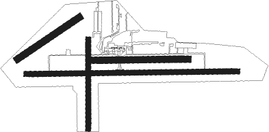
Runway info
Runway 07 / 25  | ||
| length | 1820m (5971ft) | |
| bearing | 93° / 273° | |
| width | 45m (148ft) | |
| surface | asphalt | |
| Runway 07L / 25R | ||
| length | 816m (2677ft) | |
| bearing | 93° / 273° | |
| width | 57m (187ft) | |
| surface | grass | |
| Runway 16 / 34 | ||
| length | 773m (2536ft) | |
| bearing | 185° / 5° | |
| width | 45m (148ft) | |
| surface | grass | |
| Runway 04 / 22 | ||
| length | 644m (2113ft) | |
| bearing | 66° / 246° | |
| width | 60m (197ft) | |
| surface | grass | |
Nearby beacons
| code | identifier | dist | bearing | frequency |
|---|---|---|---|---|
| TG | TAURANGA NDB | 0.4 | 221° | 346 |
| RO | ROTORUA VOR/DME | 26.7 | 165° | 112.10 |
| WK | WHAKATANE NDB | 37.3 | 109° | 362 |
| HN | HAMILTON VOR/DME | 42 | 258° | 114 |
Departure and arrival routes
| Transition altitude | 13000ft |
| Transition level | 15000ft |
| SID end points | distance | outbound heading | |
|---|---|---|---|
| RW07 | |||
| TODA2P | 20mi | 110° | |
| UBSE2P | 25mi | 297° | |
| RW25 | |||
| MORT2R | 20mi | 110° | |
| DOTAR3 | 10mi | 283° | |
| RUST2R | 25mi | 297° | |
| STAR starting points | distance | inbound heading | |
|---|---|---|---|
| RW07 | |||
| OROP1A | 15.4 | 18° | |
| FALS1A | 19.3 | 39° | |
| OLDO1A | 23.8 | 78° | |
| URBU1A | 25.0 | 106° | |
| BIKO1A | 25.0 | 115° | |
| PIBO1A | 19.8 | 290° | |
| GOBU1A | 14.7 | 346° | |
| RW25 | |||
| OROP1B | 15.4 | 18° | |
| FALS1B | 19.3 | 39° | |
| OLDO1B | 23.8 | 78° | |
| URBU1B | 25.0 | 106° | |
| BIKO1B | 25.0 | 115° | |
| PIBO1B | 19.8 | 290° | |
| GOBU1B | 14.7 | 346° | |
Instrument approach procedures
| runway | airway (heading) | route (dist, bearing) |
|---|---|---|
| RW07 | MORTA (72°) | MORTA TENIX (4mi, 5°) 2500ft |
| RW07 | RUSTA (114°) | RUSTA TENIX (4mi, 185°) 2500ft |
| RNAV | TENIX 2500ft RIPSA (4mi, 93°) 1340ft NZTG (4mi, 92°) 63ft (8538mi, 282°) 2000ft LETGU (8542mi, 102°) RUSTA (8mi, 273°) 5000ft RUSTA (turn) 5000ft | |
| RW25 | TODAN (294°) | TODAN PATMO (4mi, 4°) 2000ft |
| RW25 | UBSET (253°) | UBSET PATMO (4mi, 184°) 2000ft |
| RNAV | PATMO 2000ft UKDAS (4mi, 273°) 1340ft NZTG (5mi, 274°) 63ft (8538mi, 282°) 2000ft LETGU (8542mi, 102°) UBSET (8mi, 93°) 4000ft UBSET (turn) 4000ft |
Holding patterns
| STAR name | hold at | type | turn | heading* | altitude | leg | speed limit |
|---|---|---|---|---|---|---|---|
| BIKO1A | RUSTA | VHF | left | 343 (163)° | > 3800ft | 1.0min timed | 240 |
| BIKO1B | UBSET | VHF | right | 343 (163)° | > 1900ft | 1.0min timed | 240 |
| FALS1A | MORTA | VHF | right | 163 (343)° | > 4600ft | 1.0min timed | 240 |
| FALS1B | TODAN | VHF | right | 163 (343)° | > 3300ft | 1.0min timed | 240 |
| GOBU1A | MORTA | VHF | right | 163 (343)° | > 4600ft | 1.0min timed | 240 |
| GOBU1B | TODAN | VHF | right | 163 (343)° | > 3300ft | 1.0min timed | 240 |
| OLDO1A | MORTA | VHF | right | 163 (343)° | > 4600ft | 1.0min timed | 240 |
| OLDO1B | TODAN | VHF | right | 163 (343)° | > 3300ft | 1.0min timed | 240 |
| OROP1A | MORTA | VHF | right | 163 (343)° | > 4600ft | 1.0min timed | 240 |
| OROP1B | TODAN | VHF | right | 163 (343)° | > 3300ft | 1.0min timed | 240 |
| PIBO1A | MORTA | VHF | right | 163 (343)° | > 4600ft | 1.0min timed | 240 |
| PIBO1B | TODAN | VHF | right | 163 (343)° | > 3300ft | 1.0min timed | 240 |
| URBU1A | RUSTA | VHF | left | 343 (163)° | > 3800ft | 1.0min timed | 240 |
| URBU1B | UBSET | VHF | right | 343 (163)° | > 1900ft | 1.0min timed | 240 |
| *) magnetic outbound (inbound) holding course | |||||||
Disclaimer
The information on this website is not for real aviation. Use this data with the X-Plane flight simulator only! Data taken with kind consent from X-Plane 12 source code and data files. Content is subject to change without notice.