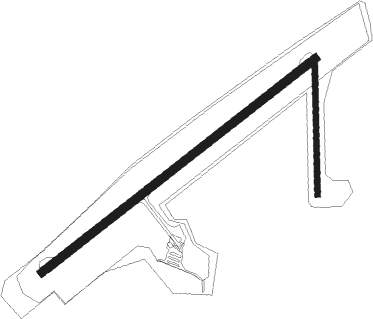
Westport
Airport details
| Country | New Zealand |
| State | West Coast |
| Region | NZ |
| Municipality | Buller District |
| Elevation | 13ft (4m) |
| Timezone | GMT +12 |
| Coordinates | -41.74029, 171.57967 |
| Magnetic var | |
| Type | land |
| Available since | X-Plane v10.40 |
| ICAO code | NZWS |
| IATA code | WSZ |
| FAA code | n/a |
Communication
| Westport CTAF | 119.100 |
| Westport CHRISTCHURCH FIS | 118.700 |
Nearby Points of Interest:
Clock Tower Chambers
-Church of St John the Evangelist
-Granity Community Library
-Reefton Power Station
Nearby beacons
| code | identifier | dist | bearing | frequency |
|---|---|---|---|---|
| WS | PORT DME | 0 | 190° | 116.90 |
| WS | WESTPORT NDB | 0.1 | 170° | 278 |
| HK | HOKITIKA NDB | 65.5 | 212° | 310 |
Departure and arrival routes
| Transition altitude | 13000ft |
| Transition level | 15000ft |
| SID end points | distance | outbound heading | |
|---|---|---|---|
| RW04 | |||
| KAKE1A | 21mi | 30° | |
| RW22 | |||
| KAKE1D | 21mi | 30° | |
| STAR starting points | distance | inbound heading | |
|---|---|---|---|
| RW04 | |||
| DAMI1E | 18.3 | 77° | |
| KAKE1E | 20.6 | 210° | |
| AKSE1E | 30.2 | 255° | |
| ESDA1E | 30.1 | 333° | |
| RW22 | |||
| DAMI1F | 18.3 | 77° | |
| AKSE1F | 30.2 | 255° | |
| ESDA1F | 30.1 | 333° | |
Instrument approach procedures
| runway | airway (heading) | route (dist, bearing) |
|---|---|---|
| RW04 | AVMAK (39°) | AVMAK BURKI (5mi, 319°) 2200ft |
| RW04 | GUNOM (85°) | GUNOM BURKI (5mi, 139°) 2200ft |
| RNAV | BURKI 2200ft WS404 (5mi, 64°) 1660ft NZWS (5mi, 65°) 63ft WS411 (5mi, 62°) GUNOM (16mi, 258°) 2200ft GUNOM (turn) 2200ft | |
| RW22 | ANSIS (210°) | ANSIS WS408 (7mi, 143°) 2400ft |
| RW22 | PILUP (243°) | PILUP WS408 (6mi, 244°) 2400ft |
| RNAV | WS408 2400ft WS411 (5mi, 244°) 1650ft NZWS (5mi, 242°) 62ft WS404 (5mi, 245°) ANSIS (18mi, 41°) 3500ft ANSIS (turn) 3500ft |
Disclaimer
The information on this website is not for real aviation. Use this data with the X-Plane flight simulator only! Data taken with kind consent from X-Plane 12 source code and data files. Content is subject to change without notice.

