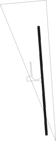
Hollis - Hollis Mun
Airport details
| Country | United States of America |
| State | Oklahoma |
| Region | K4 |
| Airspace | Ft Worth Ctr |
| Municipality | Hollis |
| Elevation | 1658ft (505m) |
| Timezone | GMT -6 |
| Coordinates | 34.70531, -99.90855 |
| Magnetic var | |
| Type | land |
| Available since | X-Plane v10.40 |
| ICAO code | O35 |
| IATA code | n/a |
| FAA code | n/a |
Communication
| Hollis Mun CTAF | 122.900 |
| Hollis Mun Altis Approach | 125.100 |
| Hollis Mun Altis Departure | 125.100 |
Nearby Points of Interest:
Hollis City Hall and Jail
-Childress Commercial and Civic Historic District
-Greer County Courthouse
-Jackson County Courthouse
-W.C. Baker House
-Magnolia Service Station
-Hall County Courthouse
-Route 66 Bridge over the Chicago, Rock Island and Gulf Railroad
Nearby beacons
| code | identifier | dist | bearing | frequency |
|---|---|---|---|---|
| CDS | CHILDRESS VORTAC | 27.6 | 229° | 117 |
| LTS | ALTUS VORTAC | 31.5 | 94° | 109.80 |
| HBR | HOBART VORTAC | 42.7 | 79° | 111.80 |
| BFV | BURNS FLAT (CLINTON) VORTAC | 47 | 53° | 110 |
| BZ | FOSSI (CLINTON) NDB | 56.6 | 43° | 393 |
| GTH | DME | 59.5 | 205° | 114.50 |
Instrument approach procedures
| runway | airway (heading) | route (dist, bearing) |
|---|---|---|
| RW18 | BFV (233°) | BFV WILVO (15mi, 244°) 3600ft AARGH (25mi, 244°) 3600ft |
| RW18 | JAPUX (26°) | JAPUX AARGH (25mi, 15°) 3600ft AARGH (turn) 3600ft |
| RW18 | JUMEK (274°) | JUMEK AARGH (23mi, 299°) 3600ft AARGH (turn) 3600ft |
| RW18 | WUDPI (130°) | WUDPI LOBIY (21mi, 121°) 4400ft RUKEE (13mi, 115°) 3700ft AARGH (4mi, 115°) 3600ft |
| RNAV | AARGH 3600ft LSLIE (6mi, 180°) 3400ft O35 (6mi, 180°) 1699ft (5894mi, 109°) 2060ft SMOTE (5895mi, 289°) 3700ft SMOTE (turn) | |
| RW36 | SMOTE (0°) | SMOTE 6000ft SMOTE (turn) 3700ft |
| RNAV | SMOTE 3700ft IZTAN (6mi, 0°) 3300ft O35 (5mi, 0°) 1699ft (5894mi, 109°) 2060ft AARGH (5892mi, 289°) 3600ft AARGH (turn) |
Disclaimer
The information on this website is not for real aviation. Use this data with the X-Plane flight simulator only! Data taken with kind consent from X-Plane 12 source code and data files. Content is subject to change without notice.
