Woodland - Watts Woodland
Airport details
| Country | United States of America |
| State | California |
| Region | K2 |
| Airspace | Oakland Ctr |
| Municipality | Yolo County |
| Elevation | 125ft (38m) |
| Timezone | GMT -8 |
| Coordinates | 38.67388, -121.87208 |
| Magnetic var | |
| Type | land |
| Available since | X-Plane v10.40 |
| ICAO code | O41 |
| IATA code | n/a |
| FAA code | O41 |
Communication
| WATTS WOODLAND CTAF/UNICOM | 122.800 |
| WATTS WOODLAND TRAVIS Approach/Departure | 126.600 |
Nearby Points of Interest:
Woodland Public Library
-Porter Building
-Yolo Branch Library
-Gibson Mansion
-Downtown Woodland Historic District
-I.O.O.F. Building
-R. H. Beamer House
-Dresbach-Hunt-Boyer House
-Downtown Winters Historic District
-American River
-I Street Bridge
-Big Four House
-Pony Express Terminal
-Heilbron House
-Mesick House
-Coolot Company Building
-Federal Building
-Sacramento City Library
-Sacramento Historic City Cemetery
-Blue Anchor Building
-J. Neely Johnson House
-Sacramento Masonic Temple
-California State Capitol
-Calpak Plant No. 11
-Firehouse No. 3
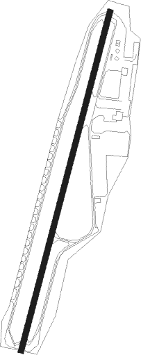
Runway info
| Runway 18 / 36 | ||
| length | 1147m (3763ft) | |
| bearing | 204° / 24° | |
| width | 18m (60ft) | |
| surface | asphalt | |
| displ threshold | 191m (627ft) / 116m (381ft) | |
Nearby beacons
| code | identifier | dist | bearing | frequency |
|---|---|---|---|---|
| SAC | SACRAMENTO VORTAC | 20.4 | 126° | 115.20 |
| MCC | MC CLELLAN (SACRAMENTO) VOR/DME | 21.9 | 91° | 109.20 |
| ILA | WILLIAMS VORTAC | 24.9 | 339° | 114.40 |
| SUU | TRAVIS (FAIRFIELD) TACAN | 25.9 | 190° | 116.60 |
| MYV | MARYSVILLE VOR/DME | 29 | 35° | 110.80 |
| BAB | BEALE (MARYSVILLE) TACAN | 34.2 | 43° | 108.60 |
| SGD | SCAGGS ISLAND (NAPA) VORTAC | 37.9 | 225° | 112.10 |
| CCR | CONCORD VOR/DME | 38.6 | 195° | 117 |
| STS | ROSA DME | 45.1 | 260° | 116.15 |
| LIN | LINDEN VOR/DME | 54.4 | 125° | 114.80 |
| SAU | SAUSALITO VOR/DME | 57.9 | 218° | 116.20 |
| PYE | POINT REYES VOR/DME | 58.9 | 239° | 113.70 |
| OAK | OAKLAND VOR/DME | 59.2 | 200° | 116.80 |
| LV | REIGA (LIVERMORE) NDB | 59.6 | 169° | 374 |
Instrument approach procedures
| runway | airway (heading) | route (dist, bearing) |
|---|---|---|
| RW36 | PIVSE (322°) | PIVSE CEVIT (12mi, 281°) 3000ft |
| RW36 | RAGGS (55°) | RAGGS CEVIT (10mi, 84°) 5000ft CEVIT (turn) 3000ft |
| RNAV | CEVIT 3000ft YUGUD (5mi, 22°) 2000ft O41 (6mi, 23°) 165ft (6867mi, 108°) 530ft CEVIT (6874mi, 288°) 3000ft CEVIT (turn) |
Disclaimer
The information on this website is not for real aviation. Use this data with the X-Plane flight simulator only! Data taken with kind consent from X-Plane 12 source code and data files. Content is subject to change without notice.