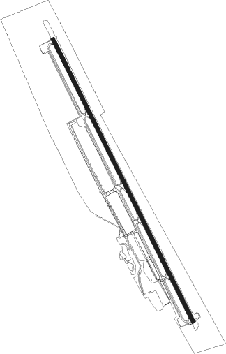
Weed
Airport details
| Country | United States of America |
| State | California |
| Region | K2 |
| Airspace | Seattle Ctr |
| Municipality | Siskiyou County |
| Elevation | 2937ft (895m) |
| Timezone | GMT -8 |
| Coordinates | 41.48080, -122.45453 |
| Magnetic var | |
| Type | land |
| Available since | X-Plane v10.40 |
| ICAO code | O46 |
| IATA code | n/a |
| FAA code | n/a |
Communication
| Weed CTAF/UNICOM | 122.700 |
Nearby Points of Interest:
Yreka
-Yreka Carnegie Library
Runway info
| Runway 14 / 32 | ||
| length | 1525m (5003ft) | |
| bearing | 152° / 332° | |
| width | 18m (60ft) | |
| surface | asphalt | |
Nearby beacons
| code | identifier | dist | bearing | frequency |
|---|---|---|---|---|
| MOG | MONTAGUE NDB | 14.8 | 354° | 404 |
| FJS | FORT JONES VOR/DME | 15.9 | 265° | 109.60 |
| LMT | KLAMATH FALLS VORTAC | 51.8 | 47° | 115.90 |
| MEF | MEDFORD NDB | 57.8 | 335° | 356 |
| RDD | REDDING VOR/DME | 59 | 171° | 108.40 |
| OED | ROGUE VALLEY (MEDFORD) VORTAC | 63.3 | 335° | 113.60 |
Departure and arrival routes
| Transition altitude | 18000ft |
| Transition level | 18000ft |
| SID end points | distance | outbound heading | |
|---|---|---|---|
| RW32 | |||
| FOBRO1 | 29mi | 341° | |
Instrument approach procedures
| runway | airway (heading) | route (dist, bearing) |
|---|---|---|
| RW14 | KLAMA (158°) | KLAMA FOBRO (15mi, 151°) 9700ft HIVEG (8mi, 151°) 8000ft EHPUG (4mi, 151°) 7400ft GRENA (4mi, 151°) 6700ft DIMGE (7mi, 175°) 5100ft |
| RNAV | DIMGE 5100ft CANKI (3mi, 190°) 4600ft ZIXIB (4mi, 159°) 3208ft (6829mi, 109°) 3343ft GRENA (6824mi, 289°) 9100ft ISAVE (11mi, 20°) KLAMA (23mi, 312°) 9100ft KLAMA (turn) |
Disclaimer
The information on this website is not for real aviation. Use this data with the X-Plane flight simulator only! Data taken with kind consent from X-Plane 12 source code and data files. Content is subject to change without notice.
