Prague - Prague Muni
Airport details
| Country | United States of America |
| State | Oklahoma |
| Region | K4 |
| Airspace | Ft Worth Ctr |
| Municipality | Prague |
| Elevation | 1041ft (317m) |
| Timezone | GMT -6 |
| Coordinates | 35.48078, -96.71875 |
| Magnetic var | |
| Type | land |
| Available since | X-Plane v10.40 |
| ICAO code | O47 |
| IATA code | n/a |
| FAA code | n/a |
Communication
| PRAGUE MUNI CTAF | 122.900 |
| PRAGUE MUNI FORT WORTH Approach/Departure | 132.200 |
Nearby Points of Interest:
St. Paul Baptist Church and Cemetery
-Beard Cabin
-Benedictine Hall
-Governor's Mansion
-Strother Memorial Chapel
-St. Cloud Hotel
-Mascho Building and Public Privy
-St. Stephen's Episcopal Church
-Conklin House
-First Presbyterian Church of Chandler
-Chandler Armory
-Joseph Carpenter House
-Seaba's Filling Station
-Seminole County Courthouse
-Threatt Filling Station
-Texaco Service Station
-Holdenville City Hall
-Holdenville Armory
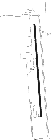
Runway info
| Runway 17 / 35 | ||
| length | 1100m (3609ft) | |
| bearing | 180° / 0° | |
| width | 18m (60ft) | |
| surface | asphalt | |
| displ threshold | 34m (112ft) / 0m (0ft) | |
Nearby beacons
| code | identifier | dist | bearing | frequency |
|---|---|---|---|---|
| SRE | SEMINOLE NDB | 12.7 | 168° | 278 |
| TIK | TINKER (OKLAHOMA CITY) TACAN | 32.4 | 266° | 115.80 |
| HET | HENRYETTA NDB | 34.7 | 96° | 267 |
| OK | PRESO (OKMULGEE) NDB | 41 | 70° | 388 |
| OKM | OKMULGEE VOR/DME | 43.5 | 76° | 114.90 |
| RG | GALLY (OKLAHOMA CITY) NDB | 44 | 258° | 350 |
| IRW | WILL ROGERS (OKLAHOMA CIT VORTAC | 44.1 | 262° | 114.10 |
| GNP | (TULSA) DME | 45.1 | 60° | 110.60 |
| PWA | WILEY POST (OKLAHOMA CITY VOR/DME | 45.4 | 273° | 113.40 |
| SWO | STILLWATER VOR/DME | 48 | 334° | 108.40 |
| SW | BLAKI (STILLWATER) NDB | 48.7 | 334° | 255 |
| TU | OILLR (TULSA) NDB | 54.8 | 53° | 338 |
| MLC | MCALESTER TACAN | 59.5 | 124° | 112 |
| TUL | TULSA VORTAC | 62.4 | 52° | 114.40 |
Instrument approach procedures
| runway | airway (heading) | route (dist, bearing) |
|---|---|---|
| RW17 | GECGE (206°) | GECGE REXEC (5mi, 254°) 3000ft |
| RW17 | IVBAF (154°) | IVBAF REXEC (5mi, 107°) 3000ft |
| RW17 | REXEC (180°) | REXEC 6000ft REXEC (turn) 3000ft |
| RNAV | REXEC 3000ft OYEHE (5mi, 180°) 2600ft UFNAP (2mi, 180°) 1840ft O47 (3mi, 180°) 1091ft (5733mi, 110°) 1400ft VIRUJ (5734mi, 290°) 3000ft VIRUJ (turn) | |
| RWNVA | VIRUJ (0°) | VIRUJ 6000ft VIRUJ (turn) 3000ft |
| RWNVA | WATOM (26°) | WATOM VIRUJ (5mi, 74°) 3000ft |
| RWNVA | XETJO (335°) | XETJO VIRUJ (5mi, 287°) 3000ft |
| RNAV | VIRUJ 3000ft YADUG (5mi, 0°) 2600ft O47 (5mi, 0°) 1060ft (5733mi, 110°) 1441ft REXEC (5733mi, 290°) 3000ft REXEC (turn) |
Disclaimer
The information on this website is not for real aviation. Use this data with the X-Plane flight simulator only! Data taken with kind consent from X-Plane 12 source code and data files. Content is subject to change without notice.