Cloverdale - Cloverdale Muni
Airport details
| Country | United States of America |
| State | California |
| Region | K2 |
| Airspace | Oakland Ctr |
| Municipality | Cloverdale |
| Elevation | 270ft (82m) |
| Timezone | GMT -8 |
| Coordinates | 38.77597, -122.99242 |
| Magnetic var | |
| Type | land |
| Available since | X-Plane v10.40 |
| ICAO code | O60 |
| IATA code | n/a |
| FAA code | n/a |
Communication
| CLOVERDALE MUNI CTAF/UNICOM | 122.800 |
Nearby Points of Interest:
madrona manor
-Healdsburg Carnegie Library
-Healdsburg Memorial Bridge
-Pond Farm
-Cunningham-Hembree Estate
-Old Lake County Courthouse
-Lakeport Carnegie Library
-James H. and Frances E. Laughlin House
-Rotchev House
-Laguna de Santa Rosa
-Hinds Hotel
-Condominium 1
-James H. Francis House
-Sam Brannan Cottage
-Duncans Point
-George A. Strout House
-McDonald Mansion
-Petaluma and Santa Rosa Railway Powerhouse
-Sebastopol station
-Luther Burbank's Gold Ridge Experiment Farm
-Railroad Square District
-Rosenberg's Department Store
-Schramsberg Vineyards
-William Hood House
-Elmshaven
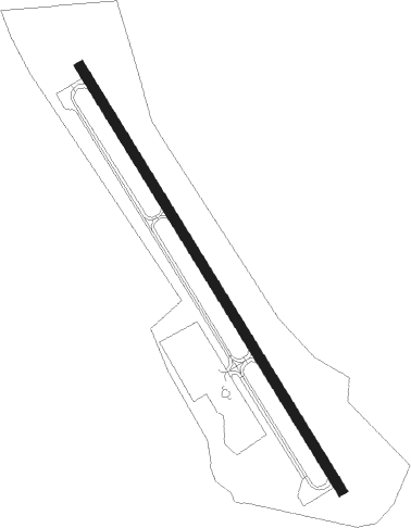
Runway info
| Runway 14 / 32 | ||
| length | 898m (2946ft) | |
| bearing | 147° / 327° | |
| width | 18m (60ft) | |
| surface | asphalt | |
| blast zone | 0m (0ft) / 61m (200ft) | |
Nearby beacons
| code | identifier | dist | bearing | frequency |
|---|---|---|---|---|
| STS | ROSA DME | 18.2 | 146° | 116.15 |
| ENI | MENDOCINO (UKIAH) VORTAC | 21.2 | 315° | 112.30 |
| UK | KEARN (UKIAH) NDB | 32.1 | 334° | 371 |
| PYE | POINT REYES VOR/DME | 42.2 | 170° | 113.70 |
| SGD | SCAGGS ISLAND (NAPA) VORTAC | 46.1 | 134° | 112.10 |
| ILA | WILLIAMS VORTAC | 48.4 | 73° | 114.40 |
| SAU | SAUSALITO VOR/DME | 59.5 | 153° | 116.20 |
| CCR | CONCORD VOR/DME | 62.5 | 128° | 117 |
Instrument approach procedures
| runway | airway (heading) | route (dist, bearing) |
|---|---|---|
| RW32 | ROZZA (326°) | ROZZA HOTIN (5mi, 332°) 3100ft |
| RNAV | HOTIN 3100ft CIMAX (7mi, 323°) 2500ft TAKUY (4mi, 324°) 940ft (6914mi, 107°) 940ft NATIC (6922mi, 288°) 6000ft NATIC (turn) 6000ft |
Disclaimer
The information on this website is not for real aviation. Use this data with the X-Plane flight simulator only! Data taken with kind consent from X-Plane 12 source code and data files. Content is subject to change without notice.