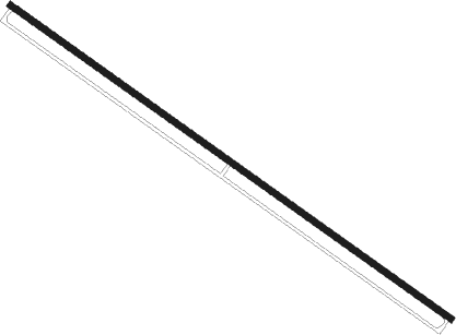
King Khaled Military City
Airport details
| Country | Saudi Arabia |
| State | Eastern Province |
| Region | OE |
| Airspace | Jeddah Ctr |
| Municipality | Hafar Al Batin Governorate |
| Elevation | 1352ft (412m) |
| Timezone | GMT +3 |
| Coordinates | 27.90088, 45.52816 |
| Magnetic var | |
| Type | land |
| Available since | X-Plane v10.40 |
| ICAO code | OEKK |
| IATA code | KMC |
| FAA code | n/a |
Communication
| KING KHALED MILITARY CITY ATIS | 127.600 |
| KING KHALED MILITARY CITY CTAF | 122.800 |
| KING KHALED MILITARY CITY INFO | 120.700 |
Approach frequencies
| ILS-cat-I | RW31 | 108.7 | 18.00mi |
| 3° GS | RW31 | 108.7 | 18.00mi |
Nearby beacons
| code | identifier | dist | bearing | frequency |
|---|---|---|---|---|
| KMC | KING SAUD AB (HAFR AL BAT VORTAC | 1.9 | 126° | 115.90 |
| HFR | HAFR AL BATIN (AL QAISUMA VORTAC | 41.5 | 52° | 113.10 |
| BPN | BOPAN VOR/DME | 51 | 186° | 113.70 |
Instrument approach procedures
| runway | airway (heading) | route (dist, bearing) |
|---|---|---|
| RW13 | DEBOL (305°) | DEBOL UKSUK (26mi, 305°) 8000ft VUSIR (38mi, 305°) 4000ft VUSIR (turn) 4000ft METSI (5mi, 127°) 3000ft |
| RW13 | HFR (232°) | HFR TASVA (43mi, 253°) 4000ft VUSIR (6mi, 174°) 4000ft METSI (5mi, 127°) 3000ft |
| RW13 | ITIXI (272°) | ITIXI SERLO (56mi, 272°) 8000ft VUSIR (36mi, 283°) 4000ft VUSIR (turn) 4000ft METSI (5mi, 127°) 3000ft |
| RNAV | METSI 3000ft OEKK (6mi, 127°) 1402ft KATOX (17mi, 127°) 5000ft KATOX (turn) | |
| RW31 | DEBOL (305°) | DEBOL UKSUK (26mi, 305°) 8000ft KATOX (10mi, 302°) 4000ft RANLA (11mi, 307°) 3000ft |
| RW31 | HFR (232°) | HFR SERLO (30mi, 191°) 4000ft KATOX (16mi, 239°) 4000ft RANLA (11mi, 307°) 3000ft |
| RW31 | ITIXI (272°) | ITIXI SERLO (56mi, 272°) 8000ft KATOX (16mi, 239°) 4000ft RANLA (11mi, 307°) 3000ft |
| RNAV | RANLA 3000ft OEKK (6mi, 307°) 1401ft OEKK (turn) 4000ft KATOX (17mi, 127°) 5000ft KATOX (turn) |
Disclaimer
The information on this website is not for real aviation. Use this data with the X-Plane flight simulator only! Data taken with kind consent from X-Plane 12 source code and data files. Content is subject to change without notice.
