Airports for X-Plane offers a convenient way to explore airports and their related communication information for the X-Plane flight simulator. It only uses data from the X-Plane flight simulator itself, and is therefore more reliable than the data that comes from real aviation websites. You can search for airports by using the ICAO code, or browse for airports per country and state. The information displayed is categorized by airport details, runway information, airport communication, approach frequencies (ILS and Glidepath details), details of nearby beacons, SIDs, STARs and approach procedures.

military drome kennedy jet ferry taxiway propeller plane jetliner regional airport check-in runway customs taxi aerodrome airborne arriving gravel aircraft hangar government

Shahid Vatan Pour Air Base

Airport details

CountryIran
StateIsfahan Province
RegionOI
AirspaceTehran Ctr
MunicipalityIsfahan
Elevation5310ft (1618m)
TimezoneGMT +3.5
Coordinates32.57084, 51.69584
Magnetic var
Typeland
Available sinceX-Plane v10.40
ICAO codeOIFH
IATA coden/a
FAA coden/a

Communication

SHAHID VATAN POUR AIR BASE Tower128.100
Nearby Points of Interest:
Al-Rashid Mausoleum
-
Church of Our Lady of the Rosary, New Julfa
-
Mollabashi House
-
Tohidkhaneh
-
Chaharbagh (Isfahan)
-
Shaykh Bahai hammam
-
Khosrow Agha Hammam
-
Molla Abdollah School
-
Emamieh school
-
Sarutaqi Complex
-
Jarchi Mosque
-
Qeysarie Bazaar
-
Chehel Dokhtaran minaret
-
Jarchi Hammam
-
Kushk Gate (Isfahan)
-
Imamzadeh Harun-e Velayat
-
Nimavard Madrasa
-
Mohammad Jafar Abadei mosque
-
Darozziafe minarets
-
Darb-e Imam
-
Ali Qoli Agha Hammam
-
Baba Ghassem Mausoleum
-
Dardasht minarets
-
Shahshahan mausoleum
-
Hafshuye mosque

Runway info

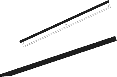
Runway 07 / 25  
 length1246m (4088ft)
 bearing78° / 258°
 width50m (165ft)
 surfacedirt
Runway 06 / 24  
 length995m (3264ft)
 bearing73° / 253°
 width23m (75ft)
 surfaceasphalt
 blast zone30m (98ft) / 0m (0ft)

Airport layout


Nearby beacons

codeidentifierdistbearingfrequency
ESHSHAHID VATAN POUR (ESFAHAN) NDB0.2206°413
IFNESFAHAN TACAN12.336°117.10
ISNESFAHAN VOR/DME12.537°113.20
IFNESFAHAN NDB14.246°337
HSAHESA (ESFAHAN) NDB22.7339°230
SKDSHAHRE KORD VOR/DME46251°117.30
SKDSHAHRE KORD NDB46.2253°376

Disclaimer

The information on this website is not for real aviation. Use this data with the X-Plane flight simulator only! Data taken with kind consent from X-Plane 12 source code and data files. Content is subject to change without notice.