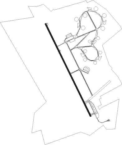
Kerman - Ayatollah Hashemi Rafsanjani
Airport details
| Country | Iran |
| State | Kerman Province |
| Region | OI |
| Airspace | Tehran Ctr |
| Municipality | Kerman |
| Elevation | 5741ft (1750m) |
| Timezone | GMT +3.5 |
| Coordinates | 30.27444, 56.95111 |
| Magnetic var | |
| Type | land |
| Available since | X-Plane v10.40 |
| ICAO code | OIKK |
| IATA code | KER |
| FAA code | n/a |
Communication
| Ayatollah Hashemi Rafsanjani ATIS | 127.250 |
| Ayatollah Hashemi Rafsanjani Tower | 122.500 |
| Ayatollah Hashemi Rafsanjani Tower | 121.900 |
Nearby Points of Interest:
Fathabad Castle (Ekhtiarabad)
-Kerman
-Ganjali Khan Ab Anbar
-Ganjali Khan Bazaar
-Ganjali Khan Mint
-Ibrahim Khan School
-Ganjali Khan Square
-Ibrahim Khan Complex
-Ibrahim Khan Hammam
-Vakil Ab Anbar (Kerman)
-Vakil Hammam (Kerman)
-Jameh Mosque of Negar
Nearby beacons
| code | identifier | dist | bearing | frequency |
|---|---|---|---|---|
| KER | KERMAN VOR/DME | 0.6 | 314° | 112 |
| KER | KERMAN NDB | 0.7 | 132° | 290 |
| RAF | RAFSANJAN NDB | 46.4 | 272° | 260 |
Departure and arrival routes
| Transition altitude | 12000ft |
| SID end points | distance | outbound heading | |
|---|---|---|---|
| RW16R | |||
| ALGU1E, ALGU1G | 31mi | 1° | |
| ALKE1D | 29mi | 100° | |
| ALKU1E | 29mi | 143° | |
| ALME1F | 30mi | 192° | |
| GETI1E | 30mi | 262° | |
| ALMO1E | 31mi | 302° | |
| RW34L | |||
| ALGU1D, ALGU1F | 31mi | 1° | |
| ALKE1C | 29mi | 100° | |
| ALKU1D | 29mi | 143° | |
| ALME1C | 30mi | 192° | |
| GETI1C | 30mi | 262° | |
| ALMO1D, ALMO1F | 31mi | 302° | |
| STAR starting points | distance | inbound heading | |
|---|---|---|---|
| RW16R | |||
| ALME1M, ALME1R | 29.6 | 12° | |
| GETI1R, GETI1M | 30.3 | 82° | |
| ALMO1S, ALMO1U, ALMO1R, ALMO1M | 30.6 | 122° | |
| ALGU1M, ALGU1R, ALGU1S, ALGU1U | 30.5 | 181° | |
| ALKE1M | 29.4 | 280° | |
| ALKU1M | 29.3 | 323° | |
| RW34L | |||
| ALME1R, ALME1M | 29.6 | 12° | |
| GETI1R, GETI1M | 30.3 | 82° | |
| ALMO1S, ALMO1M, ALMO1R, ALMO1U | 30.6 | 122° | |
| ALGU1M, ALGU1U, ALGU1R, ALGU1S | 30.5 | 181° | |
| ALKE1M | 29.4 | 280° | |
| ALKU1M | 29.3 | 323° | |
Holding patterns
| STAR name | hold at | type | turn | heading* | altitude | leg | speed limit |
|---|---|---|---|---|---|---|---|
| ALGU1R | D195L | VHF | right | 195 (15)° | 11000ft - 14000ft | 1.0min timed | 230 |
| ALGU1S | D339T | VHF | right | 339 (159)° | > 13000ft | 1.0min timed | 210 |
| ALGU1U | D339T | VHF | right | 339 (159)° | > 13000ft | 1.0min timed | 210 |
| ALME1R | D195L | VHF | right | 195 (15)° | 11000ft - 14000ft | 1.0min timed | 230 |
| ALMO1R | D195L | VHF | right | 195 (15)° | 11000ft - 14000ft | 1.0min timed | 230 |
| ALMO1S | D339T | VHF | right | 339 (159)° | > 13000ft | 1.0min timed | 210 |
| ALMO1U | D339T | VHF | right | 339 (159)° | > 13000ft | 1.0min timed | 210 |
| GETI1R | D195L | VHF | right | 195 (15)° | 11000ft - 14000ft | 1.0min timed | 230 |
| *) magnetic outbound (inbound) holding course | |||||||
Disclaimer
The information on this website is not for real aviation. Use this data with the X-Plane flight simulator only! Data taken with kind consent from X-Plane 12 source code and data files. Content is subject to change without notice.