Sabzevar
Airport details
| Country | Iran |
| State | Razavi Khorasan |
| Region | OI |
| Airspace | Tehran Ctr |
| Municipality | دهستان قصبه غربی |
| Elevation | 3009ft (917m) |
| Timezone | GMT +3.5 |
| Coordinates | 36.16861, 57.59639 |
| Magnetic var | |
| Type | land |
| Available since | X-Plane v10.40 |
| ICAO code | OIMS |
| IATA code | AFZ |
| FAA code | n/a |
Communication
| Sabzevar INFO | 121.900 |
| Sabzevar INFO | 118.150 |
Nearby Points of Interest:
Sabzevar-2 Icehouses
-Sabzevar-1 Icehouses
-Aldaghi House
-Hashtpayeh Ab Anbar
-Imamzadeh Sho'ayb
-Sarsang Ab Anbar
-Qeysariye Hammam
-Afchangi House
-Sarpushide Bazaar of Sabzevar
-Qannadha Hussainiya
-Imamzadeh Yahya (Sabzevar)
-Dodar House
-Bazaar Haj Zaman
-Paderakht Hammam
-Torshizi House
-Hejazian House
-Owliya House
-Eslami House
-Azimian House
-Shari'atmadar School
-Mrs. Kian House
-Shari'atmadar House 2
-Forughi House
-Haj Karim Ab Anbar
-Mohammadiye School
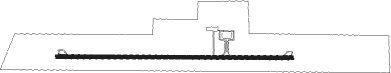
Runway info
| Runway 09 / 27 | ||
| length | 3172m (10407ft) | |
| bearing | 94° / 274° | |
| width | 45m (148ft) | |
| surface | asphalt | |
Nearby beacons
| code | identifier | dist | bearing | frequency |
|---|---|---|---|---|
| SBZ | SABZEVAR NDB | 0.2 | 316° | 255 |
| SBZ | SABZEVAR VOR/DME | 1.2 | 272° | 117 |
Departure and arrival routes
| Transition altitude | 8000ft |
| Transition level | 10000ft |
| SID end points | distance | outbound heading | |
|---|---|---|---|
| RW09 | |||
| BONE1B | 30mi | 21° | |
| RW27 | |||
| BONE1A | 30mi | 21° | |
| STAR starting points | distance | inbound heading | |
|---|---|---|---|
| ALL | |||
| BONE1C | 29.6 | 201° | |
| RW09 | |||
| BONE1B | 29.6 | 201° | |
| RW27 | |||
| BONE1A | 29.6 | 201° | |
Holding patterns
| STAR name | hold at | type | turn | heading* | altitude | leg | speed limit |
|---|---|---|---|---|---|---|---|
| BONE1A | D091P | VHF | right | 91 (271)° | > 8000ft | 1.0min timed | 220 |
| BONE1B | D271N | VHF | right | 271 (91)° | > 6000ft | 1.0min timed | 220 |
| *) magnetic outbound (inbound) holding course | |||||||
Disclaimer
The information on this website is not for real aviation. Use this data with the X-Plane flight simulator only! Data taken with kind consent from X-Plane 12 source code and data files. Content is subject to change without notice.