Chabahar - Chah Bahar
Airport details
| Country | Iran |
| State | Sistan and Baluchestan Province |
| Region | OI |
| Airspace | Tehran Ctr |
| Municipality | دهستان جهلیان |
| Elevation | 41ft (12m) |
| Timezone | GMT +3.5 |
| Coordinates | 25.44444, 60.38361 |
| Magnetic var | |
| Type | land |
| Available since | X-Plane v10.40 |
| ICAO code | OIZC |
| IATA code | ZBR |
| FAA code | n/a |
Communication
| Chah Bahar Tower | 125.200 |
| Chah Bahar Approach | 134.100 |
| Chah Bahar ATC_Approach | 123.400 |
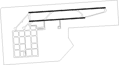
Runway info
Runway 09L / 27R  | ||
| length | 3793m (12444ft) | |
| bearing | 91° / 271° | |
| width | 46m (150ft) | |
| surface | asphalt | |
| blast zone | 255m (837ft) / 255m (837ft) | |
| Runway 09R / 27L | ||
| length | 2743m (8999ft) | |
| bearing | 91° / 271° | |
| width | 46m (150ft) | |
| surface | asphalt | |
| displ threshold | 0m (0ft) / 260m (853ft) | |
| blast zone | 255m (837ft) / 255m (837ft) | |
Nearby beacons
| code | identifier | dist | bearing | frequency |
|---|---|---|---|---|
| CBH | CHAH BAHAR VOR/DME | 1.6 | 89° | 115.60 |
Departure and arrival routes
| Transition altitude | 3000ft |
| SID end points | distance | outbound heading | |
|---|---|---|---|
| RW09 (ALL) | |||
| EGLE1H, EGLE1F | 30mi | 13° | |
| EGNU1F, EGNU1H | 28mi | 296° | |
| EGPE1F, EGPE1H | 29mi | 329° | |
| RW27 (ALL) | |||
| EGLE1G, EGLE1E | 30mi | 13° | |
| EGNU1E, EGNU1G | 28mi | 296° | |
| EGPE1E, EGPE1G | 29mi | 329° | |
| STAR starting points | distance | inbound heading | |
|---|---|---|---|
| ALL | |||
| EGNU1D, EGNU1F | 28.3 | 116° | |
| EGPE1D, EGPE1F | 29.0 | 149° | |
| EGLE1D, EGLE1F | 30.2 | 193° | |
| RW09L | |||
| EGNU1E | 28.3 | 116° | |
| EGPE1E | 29.0 | 149° | |
| EGLE1E | 30.2 | 193° | |
| RW09R | |||
| EGNU1E | 28.3 | 116° | |
| EGPE1E | 29.0 | 149° | |
| EGLE1E | 30.2 | 193° | |
Holding patterns
| STAR name | hold at | type | turn | heading* | altitude | leg | speed limit |
|---|---|---|---|---|---|---|---|
| EGLE1D | D003Q | VHF | right | 3 (183)° | > 6000ft | 1.0min timed | ICAO rules |
| EGLE1E | CD09 | VHF | right | 270 (90)° | > 3000ft | 1.0min timed | ICAO rules |
| EGNU1D | D003Q | VHF | right | 3 (183)° | > 6000ft | 1.0min timed | ICAO rules |
| EGNU1E | CD09 | VHF | right | 270 (90)° | > 3000ft | 1.0min timed | ICAO rules |
| EGPE1D | D003Q | VHF | right | 3 (183)° | > 6000ft | 1.0min timed | ICAO rules |
| EGPE1E | CD09 | VHF | right | 270 (90)° | > 3000ft | 1.0min timed | ICAO rules |
| *) magnetic outbound (inbound) holding course | |||||||
Disclaimer
The information on this website is not for real aviation. Use this data with the X-Plane flight simulator only! Data taken with kind consent from X-Plane 12 source code and data files. Content is subject to change without notice.