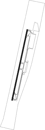
Aqaba - Aqaba - King Hussein Intl
Airport details
| Country | Jordan |
| State | Aqaba |
| Region | OJ |
| Airspace | Amman Ctr |
| Municipality | Aqaba Sub-District |
| Elevation | 172ft (52m) |
| Timezone | GMT +2 |
| Coordinates | 29.61162, 35.01807 |
| Magnetic var | |
| Type | land |
| Available since | X-Plane v10.32 |
| ICAO code | OJAQ |
| IATA code | AQJ |
| FAA code | n/a |
Communication
| Aqaba - King Hussein Intl Ground Control | 121.900 |
| Aqaba - King Hussein Intl Tower | 118.100 |
| Aqaba - King Hussein Intl Approach | 119.200 |
Approach frequencies
| ILS-cat-I | RW01 | 110.1 | 18.00mi |
| ILS-cat-I | RW19 | 110.9 | 18.00mi |
| 3° GS | RW01 | 110.1 | 18.00mi |
| 3° GS | RW19 | 110.9 | 18.00mi |
Nearby Points of Interest:
Umm Rashrash Police Station
-Timna valley
-Wadi Rum
Nearby beacons
| code | identifier | dist | bearing | frequency |
|---|---|---|---|---|
| AQB | AQABA VOR/DME | 1.8 | 199° | 113.10 |
| LOT | EILOT VOR/DME | 2.1 | 265° | 112 |
| RAM | EILAT VOR/DME | 8.4 | 1° | 113.85 |
| TBA | TABA VOR/DME | 11.5 | 269° | 114.50 |
| AQC | KING HUSSEIN NDB | 18.2 | 19° | 326 |
| NWB | NUWEIBAA NDB | 39.2 | 211° | 288 |
| ZFR | ZOFAR VOR/DME | 57.3 | 9° | 115.60 |
Departure and arrival routes
| Transition altitude | 13000ft |
| Transition level | 15000ft |
| SID end points | distance | outbound heading | |
|---|---|---|---|
| RW01 | |||
| ARABA | 112mi | 32° | |
| LOXU1J | 42mi | 34° | |
| LONO1J | 43mi | 47° | |
| TAMI1J | 41mi | 90° | |
| RW19 | |||
| PETRA | 112mi | 32° | |
| LOXU1P | 42mi | 34° | |
| LONO1P | 43mi | 47° | |
| TAMI1P | 41mi | 90° | |
| STAR starting points | distance | inbound heading | |
|---|---|---|---|
| RW01 | |||
| LOXU1H | 42.2 | 214° | |
| LONO1H | 43.0 | 227° | |
| TAMI1H | 41.4 | 270° | |
| RW19 | |||
| LOXU1Q | 42.2 | 214° | |
| LONO1Q | 43.0 | 227° | |
| TAMI1Q | 41.4 | 270° | |
Instrument approach procedures
| runway | airway (heading) | route (dist, bearing) |
|---|---|---|
| RW01 | LOXAL (344°) | LOXAL 6500ft KEDET (3mi, 285°) 5210ft GENUN (4mi, 285°) 3500ft |
| RNAV | GENUN 3500ft AQ010 (5mi, 19°) 2100ft AQ011 (3mi, 19°) 1310ft OJAQ (4mi, 19°) 224ft DAVOS (8mi, 10°) 1600ft IMSEK (23mi, 20°) 5100ft BAKIR (25mi, 187°) 8000ft BAKIR (turn) | |
| RW19 | QATIM (218°) | QATIM 8000ft GERAV (5mi, 246°) 6350ft NALBO (5mi, 246°) 4700ft |
| RNAV | NALBO 4700ft AQ192 (3mi, 199°) 3900ft AQ190 (5mi, 199°) 2400ft AQ194 (2mi, 194°) 1800ft AQ195 (3mi, 194°) 980ft AQ196 (1mi, 194°) 559ft GENUN (13mi, 199°) 4100ft LOXAL (7mi, 105°) 5100ft QATIM (34mi, 19°) 8000ft QATIM (turn) |
Disclaimer
The information on this website is not for real aviation. Use this data with the X-Plane flight simulator only! Data taken with kind consent from X-Plane 12 source code and data files. Content is subject to change without notice.
