Abu Dhabi - Abu Dhabi Northeast
Airport details
| Country | United Arab Emirates |
| State | Abu Dhabi Emirate |
| Region | |
| Airspace | Emirates Ctr |
| Municipality | Zayed Military City |
| Elevation | 219ft (67m) |
| Timezone | GMT +4 |
| Coordinates | 24.51866, 54.98030 |
| Magnetic var | |
| Type | land |
| Available since | X-Plane v10.30 |
| ICAO code | OM11 |
| IATA code | n/a |
| FAA code | n/a |
Communication
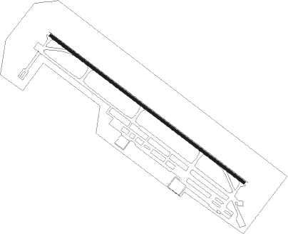
Runway info
| Runway 13 / 31 | ||
| length | 3810m (12500ft) | |
| bearing | 129° / 309° | |
| width | 46m (151ft) | |
| surface | asphalt | |
| blast zone | 255m (837ft) / 255m (837ft) | |
Nearby beacons
| code | identifier | dist | bearing | frequency |
|---|---|---|---|---|
| ADV | ABU DHABI VOR/DME | 17.8 | 252° | 114.25 |
| ALB | AL BATEEN (ABU DHABI) VOR/DME | 29.5 | 261° | 114 |
| ALA | AL AIN VOR/DME | 37.5 | 110° | 115.90 |
| ALN | AL AIN VOR/DME | 37.6 | 112° | 112.60 |
| MIN | MINHAD VOR/DME | 37.9 | 39° | 115.20 |
Disclaimer
The information on this website is not for real aviation. Use this data with the X-Plane flight simulator only! Data taken with kind consent from X-Plane 12 source code and data files. Content is subject to change without notice.