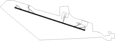
Fujairah
Airport details
| Country | United Arab Emirates |
| State | Fujairah Emirate |
| Region | OM |
| Airspace | Emirates Ctr |
| Municipality | Fujairah |
| Elevation | 150ft (46m) |
| Timezone | GMT +4 |
| Coordinates | 25.11187, 56.33053 |
| Magnetic var | |
| Type | land |
| Available since | X-Plane v10.40 |
| ICAO code | OMFJ |
| IATA code | FJR |
| FAA code | n/a |
Communication
| Fujairah Ground Control | 119.450 |
| Fujairah Tower | 124.600 |
| Fujairah Approach | 129.400 |
Approach frequencies
| ILS-cat-I | RW29 | 111.5 | 18.00mi |
| 3° GS | RW29 | 111.5 | 18.00mi |
Nearby Points of Interest:
Fortress, Diba al Hisn
Nearby beacons
| code | identifier | dist | bearing | frequency |
|---|---|---|---|---|
| FJV | FUJAIRAH VOR/DME | 1.4 | 115° | 113.80 |
| RAV | RAS AL KHAIMAH VOR/DME | 35.4 | 321° | 113.60 |
| MIN | MINHAD VOR/DME | 51.1 | 265° | 115.20 |
| ALA | AL AIN VOR/DME | 63.3 | 221° | 115.90 |
| ALN | AL AIN VOR/DME | 64.6 | 220° | 112.60 |
Departure and arrival routes
| Transition altitude | 13000ft |
| Transition level | 15000ft |
| SID end points | distance | outbound heading | |
|---|---|---|---|
| RW11 | |||
| TONV3F | 11mi | 98° | |
| VAVI1F | 65mi | 220° | |
| UMAM2F | 22mi | 228° | |
| IMPE2F | 17mi | 242° | |
| SERS3F | 46mi | 285° | |
| NOLS2F | 13mi | 297° | |
| RAK5F | 35mi | 321° | |
| GABK3F | 64mi | 331° | |
| RW29 | |||
| VAVI1N, VAVI1P | 65mi | 220° | |
| UMAM2N, UMAM2P | 22mi | 228° | |
| IMPE2N, IMPE2P | 17mi | 242° | |
| SERS3N | 46mi | 285° | |
| NOLS2N | 13mi | 297° | |
| RAK3N | 35mi | 321° | |
| GABK3N | 64mi | 331° | |
| STAR starting points | distance | inbound heading | |
|---|---|---|---|
| RW29 | |||
| RUDA2A | 20.7 | 7° | |
| KUSE2A | 12.2 | 198° | |
Instrument approach procedures
| runway | airway (heading) | route (dist, bearing) |
|---|---|---|
| RW29-Y | BORUL (291°) | BORUL 3000ft DANIG (6mi, 291°) 2000ft |
| RW29-Y | DANIG (291°) | DANIG 3000ft |
| RW29-Y | FJ361 (271°) | FJ361 3000ft DANIG (5mi, 205°) 2000ft |
| RW29-Y | FJ362 (312°) | FJ362 3000ft DANIG (5mi, 24°) 2000ft |
| RNAV | DANIG 2000ft IMKIR (6mi, 291°) 2000ft FJ929 (2mi, 291°) 1370ft FJ924 (2mi, 291°) 714ft KARER (16mi, 135°) 3000ft KARER (turn) 3000ft | |
| RW29-Z | BORUL (291°) | BORUL 3000ft DANIG (6mi, 291°) 2000ft |
| RW29-Z | DANIG (291°) | DANIG 3000ft |
| RW29-Z | FJ361 (271°) | FJ361 3000ft DANIG (5mi, 205°) 2000ft |
| RW29-Z | FJ362 (312°) | FJ362 3000ft DANIG (5mi, 24°) 2000ft |
| RNAV | DANIG 2000ft FJ363 (5mi, 291°) 2000ft FJ928 (3mi, 291°) 990ft OMFJ (4mi, 292°) 98ft FJ364 (2mi, 287°) 1200ft FJ365 (7mi, 309°) 3300ft FJ366 (7mi, 19°) 4000ft DESPA (15mi, 110°) 4000ft DESPA (turn) 4000ft |
Disclaimer
The information on this website is not for real aviation. Use this data with the X-Plane flight simulator only! Data taken with kind consent from X-Plane 12 source code and data files. Content is subject to change without notice.
