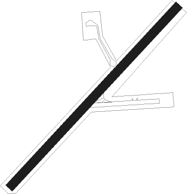
Wapinitia
Airport details
| Country | United States of America |
| State | Oregon |
| Region | |
| Airspace | Seattle Ctr |
| Municipality | Wasco County |
| Elevation | 1910ft (582m) |
| Timezone | GMT -8 |
| Coordinates | 45.14332, -121.23262 |
| Magnetic var | |
| Type | land |
| Available since | X-Plane v10.40 |
| ICAO code | OR53 |
| IATA code | n/a |
| FAA code | OR53 |
Communication
Nearby Points of Interest:
Maupin Section Foreman's House
-Barlow Road
-Clackamas Lake Ranger Station Historic District
-Antelope School
-Sherman County Courthouse
-John and Helen Moore House
-Heimrich–Seufert House
-Dr. J. A. Reuter House
-John and Murta Van Dellen House
-Orlando Humason House
-Joseph D. and Margaret Kelly House
-Hugh Glenn House
-Fulton–Taylor House
-Sharp Family Residential Ensemble
-The Dalles Carnegie Library
-The Dalles Commercial Historic District
-Edward French House
-Bennett–Williams House
-Trevitt's Addition Historic District
-U.S. Post Office
-John L. Thompson House
-Rock Fort Campsite
-Indian Shaker Church and Gulick Homestead
Nearby beacons
| code | identifier | dist | bearing | frequency |
|---|---|---|---|---|
| LTJ | KLICKITAT (THE DALLES) VOR/DME | 34.6 | 13° | 112.30 |
| DSD | DESCHUTES (REDMOND) VORTAC | 53.5 | 185° | 117.60 |
Disclaimer
The information on this website is not for real aviation. Use this data with the X-Plane flight simulator only! Data taken with kind consent from X-Plane 12 source code and data files. Content is subject to change without notice.
