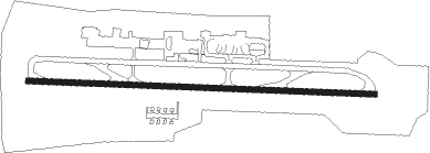
Aleppo - Aleppo Intl
Airport details
| Country | Syrian Arab Republic |
| State | Aleppo Governorate |
| Region | OS |
| Airspace | Damascus Ctr |
| Municipality | Aleppo |
| Elevation | 1274ft (388m) |
| Timezone | GMT +2 |
| Coordinates | 36.18048, 37.22676 |
| Magnetic var | |
| Type | land |
| Available since | X-Plane v10.30 |
| ICAO code | OSAP |
| IATA code | ALP |
| FAA code | n/a |
Communication
| Aleppo Intl Tower | 118.100 |
| Aleppo Intl Tower | 119.100 |
| Aleppo Intl Approach | 119.100 |
| Aleppo Intl Approach | 118.100 |
Approach frequencies
| ILS-cat-II | RW27 | 110.1 | 18.00mi |
| 3° GS | RW27 | 110.1 | 18.00mi |
Nearby Points of Interest:
Bimaristan Arghun al-Kamili
-Souq Khan al-Wazir
-Ancient City of Aleppo
-Mushabbak
-Sitt er-Rum (Syria)
-Ba'uda (Dschebel Barisha)
Nearby beacons
| code | identifier | dist | bearing | frequency |
|---|---|---|---|---|
| ALE | ALEPPO NDB | 0.3 | 328° | 396 |
| ALE | ALEPPO VOR/DME | 0.8 | 267° | 114.50 |
| MER | ALEPPO NDB | 3.9 | 95° | 365 |
| HTY | HATAY NDB | 46.6 | 281° | 336 |
| GAZ | GAZIANTEP NDB | 47.8 | 18° | 432 |
Departure and arrival routes
| Transition altitude | 13000ft |
| Transition level | 15000ft |
| SID end points | distance | outbound heading | |
|---|---|---|---|
| RW09 | |||
| GOLF2J, GOLF1J | 14mi | 16° | |
| DELT1J | 14mi | 107° | |
| TANG1J | 15mi | 155° | |
| KILO1J | 12mi | 184° | |
| LIMA1J | 13mi | 235° | |
| NOVM1E | 46mi | 316° | |
| RW27 | |||
| GOLF2R, GOLF1R | 14mi | 16° | |
| DELT1R | 14mi | 107° | |
| TANG1R | 15mi | 155° | |
| KILO1R | 12mi | 184° | |
| LIMA1R | 13mi | 235° | |
| NOVM1W | 46mi | 316° | |
| STAR starting points | distance | inbound heading | |
|---|---|---|---|
| ALL | |||
| KILO1C | 11.7 | 4° | |
| LUBA2C | 45.7 | 53° | |
| LIMA1C | 13.2 | 55° | |
| GOLF1C, GOLF2C | 13.8 | 196° | |
| DELT1C, DELT2C | 14.1 | 287° | |
| TAN2C | 176.6 | 332° | |
| TANG1C | 14.8 | 335° | |
Disclaimer
The information on this website is not for real aviation. Use this data with the X-Plane flight simulator only! Data taken with kind consent from X-Plane 12 source code and data files. Content is subject to change without notice.