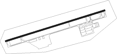
Aden - Aden Intl
Airport details
| Country | Yemen |
| State | Aden Governorate |
| Region | OY |
| Airspace | Sanaa Ctr |
| Municipality | Aden City |
| Elevation | 4ft (1m) |
| Timezone | GMT +3 |
| Coordinates | 12.82727, 45.03052 |
| Magnetic var | |
| Type | land |
| Available since | X-Plane v10.30 |
| ICAO code | OYAA |
| IATA code | ADE |
| FAA code | n/a |
Communication
| Aden Intl ATIS | 122.600 |
| Aden Intl Ground Control | 121.900 |
| Aden Intl Tower | 118.700 |
| Aden Intl Approach | 119.700 |
Approach frequencies
| ILS-cat-I | RW08 | 110.3 | 18.00mi |
| 3° GS | RW08 | 110.3 | 18.00mi |
Runway info
| Runway 08 / 26 | ||
| length | 3103m (10180ft) | |
| bearing | 77° / 257° | |
| width | 45m (148ft) | |
| surface | asphalt | |
| blast zone | 60m (197ft) / 60m (197ft) | |
Nearby beacons
| code | identifier | dist | bearing | frequency |
|---|---|---|---|---|
| KRA | ADEN VOR/DME | 0.4 | 299° | 112.50 |
| AD | ADEN NDB | 2.9 | 330° | 361 |
| TAZ | TAIZ VOR/DME | 73.8 | 314° | 113.60 |
Departure and arrival routes
| Transition altitude | 13000ft |
| Transition level | 15000ft |
| STAR starting points | distance | inbound heading | |
|---|---|---|---|
| ALL | |||
| SAP11 | 57.4 | 79° | |
| SAP10 | 73.8 | 134° | |
| SAP7A, SAP7B | 90.0 | 156° | |
| SAP8 | 164.5 | 227° | |
Disclaimer
The information on this website is not for real aviation. Use this data with the X-Plane flight simulator only! Data taken with kind consent from X-Plane 12 source code and data files. Content is subject to change without notice.
