Bisbee Muni
Airport details
| Country | United States of America |
| State | Arizona |
| Region | K2 |
| Airspace | Albuquerque Ctr |
| Municipality | Cochise County |
| Elevation | 4729ft (1441m) |
| Timezone | GMT -7 |
| Coordinates | 31.36399, -109.88313 |
| Magnetic var | |
| Type | land |
| Available since | X-Plane v10.40 |
| ICAO code | P04 |
| IATA code | n/a |
| FAA code | n/a |
Communication
| Bisbee Muni CTAF/UNICOM | 122.800 |
Nearby Points of Interest:
Naco Border Station
-Bisbee Woman's Club Clubhouse
-Phelps Dodge General Office Building
-St. Patrick's Roman Catholic Church
-Grand Theatre
-El Paso and Southwestern Railroad YMCA
-United States Post Office and Customs House–Douglas Main
-Kinjockity Ranch
-Double Adobe Site
-Douglas Municipal Airport
-Coronado National Memorial
-Tombstone Courthouse State Historic Park
-Tombstone Historic District
-Sacred Heart Church
-Fort Huachuca
-Cananea city hall
-Canelo School
-Canelo Ranger Station
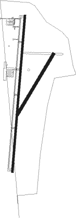
Runway info
Runway 17 / 35  | ||
| length | 1805m (5922ft) | |
| bearing | 191° / 11° | |
| width | 21m (70ft) | |
| surface | asphalt | |
| Runway 02 / 20 | ||
| length | 809m (2654ft) | |
| bearing | 40° / 220° | |
| width | 34m (110ft) | |
| surface | dirt | |
Nearby beacons
| code | identifier | dist | bearing | frequency |
|---|---|---|---|---|
| DUG | DOUGLAS VORTAC | 15.8 | 69° | 108.80 |
| ARH | FORT HUACHUCA TACAN | 26.8 | 296° | 111.60 |
| FHU | LIBBY (FT HUACHUCA) VOR/DME | 27.7 | 296° | 113.60 |
| OLS | NOGALES VOR/DME | 49.6 | 273° | 108.20 |
| SSO | SAN SIMON VORTAC | 62.9 | 34° | 115.40 |
| DMA | DAVIS-MONTHAN (TUCSON) TACAN | 69.8 | 309° | 117.60 |
Disclaimer
The information on this website is not for real aviation. Use this data with the X-Plane flight simulator only! Data taken with kind consent from X-Plane 12 source code and data files. Content is subject to change without notice.