Hawley - Mountain Bay Air Park Inc
Airport details
| Country | United States of America |
| State | Pennsylvania |
| Region | |
| Airspace | New York Ctr |
| Municipality | Pike County |
| Elevation | 1500ft (457m) |
| Timezone | GMT -5 |
| Coordinates | 41.38084, -75.23618 |
| Magnetic var | |
| Type | land |
| Available since | X-Plane v10.40 |
| ICAO code | PA49 |
| IATA code | n/a |
| FAA code | PA49 |
Communication
Nearby Points of Interest:
Lacawac
-Promised Land State Park Whittaker Lodge District
-Bellemonte Silk Mill
-J.S. O'Connor American Rich Cut Glassware Factory
-Bridge in Dreher Township
-Patriotic Order Sons of America Washington Camp 422
-Lord House
-Eugene Dorflinger Estate
-Octagon Stone Schoolhouse
-Honesdale Residential Historic District
-Delaware and Hudson Canal Company Office
-Wilmot House
-Wilmot Mansion
-Narrowsburg Methodist Church
-Carbondale City Hall and Courthouse
-Joseph Cassese House
-Harrison Avenue Bridge
-North Scranton Junior High School
-Pocono Manor Historic District
-James Madison School
-Scranton Armory
-Grey Towers National Historic Site
-Century Club of Scranton
-Milanville Historic District
-Florence Apartments
Runway info
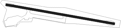
| Runway 12 / 30 | ||
| length | 671m (2201ft) | |
| bearing | 101° / 281° | |
| width | 15m (50ft) | |
| surface | asphalt | |
| displ threshold | 90m (295ft) / 0m (0ft) | |
Nearby beacons
| code | identifier | dist | bearing | frequency |
|---|---|---|---|---|
| LVZ | WILKES-BARRE VORTAC | 21.4 | 257° | 111.60 |
| STW | STILLWATER VOR/DME | 28.4 | 136° | 109.60 |
| HUO | HUGUENOT VOR/DME | 29 | 87° | 116.10 |
| SAX | SPARTA VORTAC | 36.7 | 114° | 115.70 |
| BWZ | BROADWAY (SCHOOLEY'S MT) VOR/DME | 39.6 | 145° | 114.20 |
| FJC | ALLENTOWN VORTAC | 40.5 | 198° | 117.50 |
| HNK | HANCOCK VOR/DME | 41.1 | 353° | 116.80 |
| DNY | DE LANCEY VOR/DME | 49.4 | 19° | 112.10 |
| MM | MOREE (MORRISTOWN) NDB | 50.6 | 119° | 392 |
| ETX | EAST TEXAS VOR/DME | 52.1 | 209° | 110.20 |
| SBJ | SOLBERG VOR/DME | 52.8 | 148° | 112.90 |
| CAT | CHATHAM NDB | 53 | 128° | 254 |
| CFB | BINGHAMTON VOR/DME | 61.6 | 311° | 112.20 |
Disclaimer
The information on this website is not for real aviation. Use this data with the X-Plane flight simulator only! Data taken with kind consent from X-Plane 12 source code and data files. Content is subject to change without notice.