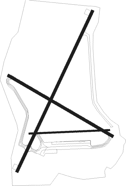
Delta Junction Ft Greely - Allen Aaf
Airport details
| Country | United States of America |
| State | Alaska |
| Region | PA |
| Municipality | Delta Junction |
| Elevation | 1291ft (393m) |
| Timezone | GMT -9 |
| Coordinates | 63.99516, -145.72003 |
| Magnetic var | |
| Type | land |
| Available since | X-Plane v10.30 |
| ICAO code | PABI |
| IATA code | BIG |
| FAA code | BIG |
Communication
| Allen AAF ATIS | 132.075 |
| Allen AAF ASOS | 135.650 |
| Allen AAF CTAF | 122.900 |
| Allen AAF FORT GREELY Ground Control | 118.225 |
| Allen AAF Tower | 125.325 |
Approach frequencies
| ILS-cat-I | RW10 | 111.1 | 18.00mi |
| 3° GS | RW10 | 111.1 | 18.00mi |
Nearby Points of Interest:
Sullivan Roadhouse
-Big Delta Historic District
Runway info
Nearby beacons
| code | identifier | dist | bearing | frequency |
|---|---|---|---|---|
| BIG | BIG DELTA VORTAC | 0.5 | 17° | 114.90 |
| DJN | DELTA JUNCTION NDB | 1.9 | 50° | 347 |
Instrument approach procedures
| runway | airway (heading) | route (dist, bearing) |
|---|---|---|
| RW10 | HUTIL (189°) | HUTIL ARORA (7mi, 266°) 5000ft OSUBE (11mi, 250°) 5000ft |
| RNAV | OSUBE 5000ft WOSOM (10mi, 107°) 3600ft HETMU (5mi, 107°) 2100ft PABI (3mi, 107°) 1305ft (6681mi, 114°) 1580ft POVLE (6681mi, 294°) VOPCU (8mi, 70°) ARORA (20mi, 291°) 5000ft ARORA (turn) | |
| RW19 | DONEL (351°) | DONEL MEYLE (17mi, 65°) 8400ft GUZHA (15mi, 336°) 5100ft DUBEY (5mi, 284°) 3800ft |
| RW19 | RIVOR (111°) | RIVOR AYJAY (13mi, 84°) 5000ft DUBEY (5mi, 104°) 3800ft |
| RNAV | DUBEY 3800ft NUXTE (6mi, 233°) 2800ft CUVRU (5mi, 233°) 1340ft (6680mi, 114°) 1691ft AYJAY (6670mi, 294°) 5000ft AYJAY (turn) |
Disclaimer
The information on this website is not for real aviation. Use this data with the X-Plane flight simulator only! Data taken with kind consent from X-Plane 12 source code and data files. Content is subject to change without notice.

