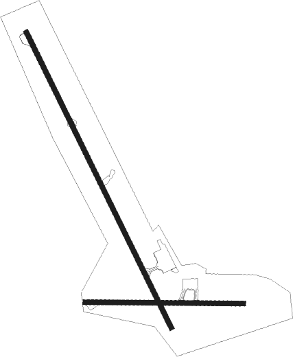
Cold Bay
Airport details
| Country | United States of America |
| State | Alaska |
| Region | PA |
| Municipality | Cold Bay |
| Elevation | 98ft (30m) |
| Timezone | GMT -9 |
| Coordinates | 55.20526, -162.72452 |
| Magnetic var | |
| Type | land |
| Available since | X-Plane v10.40 |
| ICAO code | PACD |
| IATA code | CDB |
| FAA code | CDB |
Communication
| Cold Bay ASOS | 135.750 |
| Cold Bay CTAF | 123.600 |
Approach frequencies
| ILS-cat-I | RW15 | 110.3 | 18.00mi |
| 3.1° GS | RW15 | 110.3 | 18.00mi |
Nearby beacons
| code | identifier | dist | bearing | frequency |
|---|---|---|---|---|
| CDB | COLD BAY VORTAC | 4 | 321° | 112.60 |
| ELF | ELFEE (COLD BAY) NDB | 5.8 | 325° | 341 |
Departure and arrival routes
| Transition altitude | 18000ft |
| Transition level | 18000ft |
| SID end points | distance | outbound heading | |
|---|---|---|---|
| RW08 | |||
| WETSI2 | 42mi | 52° | |
| CHUNA2 | 83mi | 262° | |
| RW15 | |||
| WETSI2 | 42mi | 52° | |
| CHUNA2 | 83mi | 262° | |
| RW26 | |||
| WETSI2 | 42mi | 52° | |
| CHUNA2 | 83mi | 262° | |
| RW33 | |||
| WETSI2 | 42mi | 52° | |
| CHUNA2 | 83mi | 262° | |
Instrument approach procedures
| runway | airway (heading) | route (dist, bearing) |
|---|---|---|
| RW15 | AFVEK (314°) | AFVEK DEADS (29mi, 319°) 4100ft DEADS (turn) 3000ft |
| RW15 | BINAL (232°) | BINAL RIGTE (29mi, 246°) 3700ft DEADS (8mi, 257°) 3000ft |
| RW15 | CDB (141°) | CDB DEADS (10mi, 326°) 3000ft DEADS (turn) 3000ft |
| RW15 | CHUNA (86°) | CHUNA GENFU (23mi, 65°) 4100ft DEADS (8mi, 81°) 3000ft |
| RW15 | ELF (145°) | ELF DEADS (8mi, 325°) 3000ft DEADS (turn) 3000ft |
| RW15 | LAPLE (230°) | LAPLE RIGTE (8mi, 277°) 3000ft DEADS (8mi, 257°) 3000ft |
| RW15 | SAFKO (230°) | SAFKO RIGTE (28mi, 244°) 3700ft DEADS (8mi, 257°) 3000ft |
| RNAV | DEADS 3000ft JEGNO (8mi, 145°) 1800ft COTRA (3mi, 145°) 760ft PACD (3mi, 144°) 128ft (7388mi, 109°) 275ft PABGE (7391mi, 289°) AFVEK (12mi, 131°) 4100ft AFVEK (turn) 4100ft | |
| RW26 | BINAL (232°) | BINAL GLENT (28mi, 236°) 3700ft LEMMR (9mi, 131°) 3000ft |
| RW26 | GENFU (116°) | GENFU GLENT (20mi, 88°) 3700ft LEMMR (9mi, 131°) 3000ft |
| RW26 | SAFKO (230°) | SAFKO GLENT (28mi, 233°) 3700ft LEMMR (9mi, 131°) 3000ft |
| RW26 | UNETE (97°) | UNETE GLENT (21mi, 73°) 3700ft LEMMR (9mi, 131°) 3000ft |
| RNAV | LEMMR 3000ft SOTOE (7mi, 245°) 1900ft ATELE (5mi, 264°) 299ft (7388mi, 109°) 800ft GLENT (7374mi, 289°) 3700ft GLENT (turn) 3700ft | |
| RW33 | CDB (141°) | CDB EPHEX (18mi, 145°) 3800ft EPHEX (turn) 3800ft |
| RW33 | CHUNA (86°) | CHUNA BUKAY (34mi, 106°) 4500ft EPHEX (8mi, 60°) 3800ft |
| RW33 | ELF (145°) | ELF EPHEX (19mi, 145°) 3800ft EPHEX (turn) 3800ft |
| RW33 | MILAM (263°) | MILAM AVVUH (22mi, 235°) 5600ft EPHEX (10mi, 263°) 3800ft |
| RNAV | EPHEX 3800ft ODOWO (6mi, 325°) 2300ft PABGE (4mi, 325°) 1100ft PACD (4mi, 326°) 148ft (7388mi, 109°) 293ft DEADS (7378mi, 289°) 3000ft DEADS (turn) |
Disclaimer
The information on this website is not for real aviation. Use this data with the X-Plane flight simulator only! Data taken with kind consent from X-Plane 12 source code and data files. Content is subject to change without notice.

