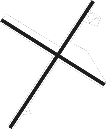
Deering
Airport details
| Country | United States of America |
| State | Alaska |
| Region | PA |
| Municipality | Deering |
| Elevation | 20ft (6m) |
| Timezone | GMT -9 |
| Coordinates | 66.06911, -162.76706 |
| Magnetic var | |
| Type | land |
| Available since | X-Plane v10.40 |
| ICAO code | PADE |
| IATA code | DRG |
| FAA code | DEE |
Communication
| DEERING ASOS | 135.500 |
| DEERING CTAF | 122.900 |
| DEERING ANCHORAGE CNTR | 119.200 |
Nearby beacons
| code | identifier | dist | bearing | frequency |
|---|---|---|---|---|
| OTZ | KOTZEBUE VOR/DME | 49.3 | 16° | 115.70 |
| HHM | HOTHAM (KOTZEBUE) NDB | 50.2 | 14° | 356 |
Instrument approach procedures
| runway | airway (heading) | route (dist, bearing) |
|---|---|---|
| RW03 | COTUS (79°) | COTUS RAVOY (8mi, 107°) 4300ft |
| RW03 | DOKAC (26°) | DOKAC RAVOY (8mi, 288°) 4300ft |
| RW03 | RAVOY (62°) | RAVOY 4300ft |
| RNAV | RAVOY 4300ft HALEY (8mi, 62°) 2600ft GIDBE (5mi, 62°) 1040ft PADE (3mi, 62°) 68ft (6774mi, 112°) 275ft FEGEK (6761mi, 292°) 3700ft FEGEK (turn) | |
| RW12 | CIRAC (136°) | CIRAC SAGKO (8mi, 241°) 3000ft |
| RW12 | DICDE (92°) | DICDE SAGKO (8mi, 61°) 3000ft |
| RW12 | SAGKO (107°) | SAGKO 3000ft |
| RNAV | SAGKO 3000ft FIBEB (8mi, 106°) 1600ft PADE (5mi, 107°) 80ft (6774mi, 112°) 430ft SAGKO (6770mi, 292°) 3000ft SAGKO (turn) | |
| RW21 | FEGEK (243°) | FEGEK 3700ft |
| RW21 | NANRE (261°) | NANRE FEGEK (8mi, 288°) 3700ft |
| RW21 | PORIC (200°) | PORIC FEGEK (8mi, 108°) 3700ft |
| RNAV | FEGEK 3700ft HOREL (9mi, 243°) 1500ft PADE (5mi, 243°) 65ft (6774mi, 112°) 275ft RAVOY (6789mi, 292°) 4300ft RAVOY (turn) | |
| RW30 | GOTGE (287°) | GOTGE 3600ft |
| RW30 | JALNU (312°) | JALNU GOTGE (8mi, 61°) 3600ft |
| RW30 | KALKE (273°) | KALKE GOTGE (8mi, 242°) 3600ft |
| RNAV | GOTGE 3600ft JEMUM (8mi, 287°) 2000ft NARIY (2mi, 287°) 1300ft PADE (4mi, 287°) 70ft (6774mi, 112°) 430ft SAGKO (6770mi, 292°) 3000ft SAGKO (turn) |
Disclaimer
The information on this website is not for real aviation. Use this data with the X-Plane flight simulator only! Data taken with kind consent from X-Plane 12 source code and data files. Content is subject to change without notice.

