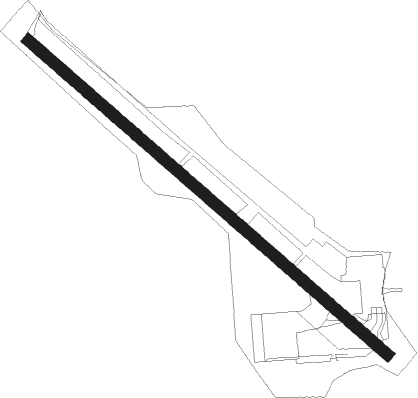
Unalaska
Airport details
| Country | United States of America |
| State | Alaska |
| Region | PA |
| Municipality | Unalaska |
| Elevation | 20ft (6m) |
| Timezone | GMT -9 |
| Coordinates | 53.89894, -166.54503 |
| Magnetic var | |
| Type | land |
| Available since | X-Plane v10.40 |
| ICAO code | PADU |
| IATA code | DUT |
| FAA code | DUT |
Communication
| UNALASKA AWOS 3 | 125.800 |
| UNALASKA CTAF | 122.600 |
| UNALASKA ANCHORAGE Approach | 121.400 |
| UNALASKA ANCHORAGE Departure | 121.400 |
Nearby Points of Interest:
Dutch Harbor Naval Operating Base and Fort Mears, U.S. Army
-Sitka Spruce Park
-SS Northwestern
Nearby beacons
| code | identifier | dist | bearing | frequency |
|---|---|---|---|---|
| DUT | DUTCH HARBOR NDB | 0.3 | 335° | 283 |
Instrument approach procedures
| runway | airway (heading) | route (dist, bearing) |
|---|---|---|
| RW13 | EWSER (167°) | EWSER 2300ft |
| RW13 | MORDI (237°) | MORDI ROFZU (58mi, 246°) 2300ft EWSER (11mi, 242°) 2300ft |
| RNAV | EWSER 2300ft IRUWU (6mi, 168°) 1600ft OWGIM (5mi, 168°) 500ft ROFZU (20mi, 33°) 2300ft ROFZU (turn) | |
| RW31 | MORDI (237°) | MORDI ROFZU (58mi, 246°) 2300ft VOVUC (10mi, 167°) 2300ft |
| RW31 | VOVUC (223°) | VOVUC 2300ft |
| RNAV | VOVUC 2300ft ICYOH (6mi, 219°) 1600ft DAWKU (5mi, 219°) 500ft (7500mi, 108°) 500ft ROFZU (7481mi, 288°) 2300ft ROFZU (turn) | |
| RWNVB | MORDI (237°) | MORDI ALEUT (65mi, 247°) 3500ft EYUYO (8mi, 199°) 2500ft |
| RNAV | EYUYO 2500ft AFPIV (6mi, 168°) 2500ft USUHU (3mi, 168°) 2500ft (7502mi, 108°) 2500ft ALEUT (7485mi, 288°) 3600ft ALEUT (turn) |
Disclaimer
The information on this website is not for real aviation. Use this data with the X-Plane flight simulator only! Data taken with kind consent from X-Plane 12 source code and data files. Content is subject to change without notice.
