Kenai - Kenai Muni
Airport details
| Country | United States of America |
| State | Alaska |
| Region | PA |
| Municipality | Kenai |
| Elevation | 99ft (30m) |
| Timezone | GMT -9 |
| Coordinates | 60.57066, -151.24109 |
| Magnetic var | |
| Type | land |
| Available since | X-Plane v10.40 |
| ICAO code | PAEN |
| IATA code | ENA |
| FAA code | ENA |
Communication
| Kenai Muni ATIS | 133.350 |
| Kenai Muni CTAF | 121.300 |
| Kenai Muni Ground Control | 118.750 |
| Kenai Muni Tower | 121.300 |
Approach frequencies
| ILS-cat-I | RW20R | 108.9 | 18.00mi |
| 3° GS | RW20R | 108.9 | 18.00mi |
Nearby Points of Interest:
Soldotna Post Office
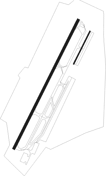
Runway info
Runway 2L / 20R  | ||
| length | 2389m (7838ft) | |
| bearing | 51° / 231° | |
| width | 46m (151ft) | |
| surface | asphalt | |
| displ threshold | 82m (269ft) / 0m (0ft) | |
| blast zone | 52m (171ft) / 61m (200ft) | |
| Runway 02R / 20L | ||
| length | 608m (1995ft) | |
| bearing | 51° / 231° | |
| width | 18m (59ft) | |
| surface | gravel | |
Nearby beacons
| code | identifier | dist | bearing | frequency |
|---|---|---|---|---|
| ENA | KENAI VOR/DME | 2.9 | 46° | 117.60 |
| OLT | SOLDOTNA NDB | 12.1 | 105° | 346 |
| HOM | HOMER VOR/DME | 52.1 | 194° | 114.60 |
| ACE | KACHEMAK (HOMER) NDB | 56.3 | 196° | 277 |
Instrument approach procedures
| runway | airway (heading) | route (dist, bearing) |
|---|---|---|
| RW02L | ACIGE (76°) | ACIGE FOPTY (10mi, 96°) 2000ft |
| RW02L | ENA (226°) | ENA FOPTY (15mi, 231°) 2000ft FOPTY (turn) 2000ft |
| RW02L | KASSI (10°) | KASSI FOPTY (9mi, 308°) 2000ft |
| RNAV | FOPTY 2000ft CAPRU (6mi, 50°) 1700ft PAEN (5mi, 53°) 143ft (6938mi, 112°) 344ft TBONE (6927mi, 292°) 2000ft TBONE (turn) | |
| RW20R | ENA (226°) | ENA TBONE (8mi, 51°) 2000ft TBONE (turn) 2000ft |
| RW20R | YILUS (178°) | YILUS TBONE (9mi, 121°) 2000ft |
| RW20R | ZUTOR (254°) | ZUTOR TBONE (9mi, 274°) 2000ft |
| RNAV | TBONE 2000ft FREDE (6mi, 231°) 1400ft PAEN (5mi, 228°) 149ft (6938mi, 112°) 298ft FOPTY (6949mi, 292°) 2000ft FOPTY (turn) |
Disclaimer
The information on this website is not for real aviation. Use this data with the X-Plane flight simulator only! Data taken with kind consent from X-Plane 12 source code and data files. Content is subject to change without notice.