Gustavus
Airport details
| Country | United States of America |
| State | Alaska |
| Region | PA |
| Municipality | Gustavus |
| Elevation | 34ft (10m) |
| Timezone | GMT -9 |
| Coordinates | 58.42528, -135.70741 |
| Magnetic var | |
| Type | land |
| Available since | X-Plane v10.40 |
| ICAO code | PAGS |
| IATA code | GST |
| FAA code | GST |
Communication
| Gustavus AWOS 3 | 125.900 |
| Gustavus CTAF | 122.500 |
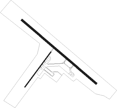
Runway info
Runway 11 / 29  | ||
| length | 2044m (6706ft) | |
| bearing | 118° / 298° | |
| width | 46m (150ft) | |
| surface | asphalt | |
| Runway 2 / 20 | ||
| length | 915m (3002ft) | |
| bearing | 59° / 239° | |
| width | 18m (60ft) | |
| surface | asphalt | |
Nearby beacons
| code | identifier | dist | bearing | frequency |
|---|---|---|---|---|
| SSR | SISTERS ISLAND VORTAC | 20.5 | 119° | 114 |
| EEF | ELEPHANT (SISTERS I.) NDB | 20.8 | 119° | 391 |
| HNS | HAINES NDB | 48 | 19° | 245 |
Departure and arrival routes
| Transition altitude | 18000ft |
| Transition level | 18000ft |
| SID end points | distance | outbound heading | |
|---|---|---|---|
| RW02 | |||
| GSTVS2 | 21mi | 119° | |
| RW11 | |||
| GSTVS2 | 21mi | 119° | |
| RW20 | |||
| GSTVS2 | 21mi | 119° | |
| RW29 | |||
| GSTVS2 | 21mi | 119° | |
Instrument approach procedures
| runway | airway (heading) | route (dist, bearing) |
|---|---|---|
| RW29 | BARLO (275°) | BARLO SSR (16mi, 244°) 5200ft MITBE (11mi, 293°) 3000ft |
| RW29 | CSPER (76°) | CSPER RUKIE (32mi, 91°) 5400ft JOBNO (4mi, 61°) 3700ft MITBE (4mi, 26°) 3000ft |
| RW29 | PELTE (315°) | PELTE PUVPE (9mi, 321°) 4500ft MITBE (9mi, 321°) 3000ft |
| RW29 | WIVEK (301°) | WIVEK SSR (10mi, 307°) 5200ft MITBE (11mi, 293°) 3000ft |
| RNAV | MITBE 3000ft PEREE (4mi, 321°) 1700ft YEBUR (2mi, 298°) 1100ft ZONEX (3mi, 298°) 293ft (6727mi, 113°) 1000ft SSR (6726mi, 293°) 3000ft SSR (turn) |
Disclaimer
The information on this website is not for real aviation. Use this data with the X-Plane flight simulator only! Data taken with kind consent from X-Plane 12 source code and data files. Content is subject to change without notice.