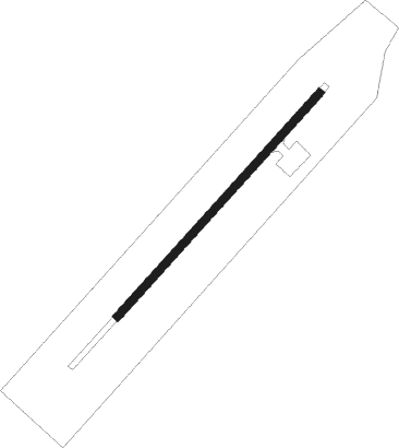
Kaltag
Airport details
| Country | United States of America |
| State | Alaska |
| Region | PA |
| Municipality | Kaltag |
| Elevation | 187ft (57m) |
| Timezone | GMT -9 |
| Coordinates | 64.31898, -158.74130 |
| Magnetic var | |
| Type | land |
| Available since | X-Plane v10.40 |
| ICAO code | PAKV |
| IATA code | KAL |
| FAA code | KAL |
Communication
| Kaltag AWOS | 132.525 |
| Kaltag ASOS | 135.250 |
| Kaltag CTAF | 122.900 |
Runway info
| Runway 03 / 21 | ||
| length | 1216m (3990ft) | |
| bearing | 68° / 248° | |
| width | 30m (100ft) | |
| surface | gravel | |
Departure and arrival routes
| Transition altitude | 18000ft |
| Transition level | 18000ft |
| SID end points | distance | outbound heading | |
|---|---|---|---|
| RW03 | |||
| KACLE2 | 43mi | 207° | |
Instrument approach procedures
| runway | airway (heading) | route (dist, bearing) |
|---|---|---|
| RW03 | KICEN (73°) | KICEN 5500ft KUTTE (5mi, 107°) 4600ft |
| RW03 | KUTTE (59°) | KUTTE 4600ft |
| RW03 | LEMRE (36°) | LEMRE 5500ft KUTTE (5mi, 288°) 4600ft |
| RNAV | KUTTE 4600ft JEDIT (4mi, 59°) 3400ft LUCIY (2mi, 59°) 2800ft HEGLA (4mi, 59°) 1600ft FIGED (4mi, 59°) 381ft (6836mi, 112°) 581ft KUTTE (6850mi, 292°) 4600ft KUTTE (turn) | |
| RW21 | CIMUL (261°) | CIMUL 5100ft FEPNO (5mi, 295°) 3300ft |
| RW21 | FEPNO (248°) | FEPNO 3300ft |
| RW21 | LENOW (226°) | LENOW 4700ft FEPNO (5mi, 115°) 3300ft |
| RNAV | FEPNO 3300ft CIKET (6mi, 248°) 2100ft PAKV (6mi, 248°) 222ft ARWUC (4mi, 248°) KUTTE (10mi, 236°) 4600ft KUTTE (turn) |
Disclaimer
The information on this website is not for real aviation. Use this data with the X-Plane flight simulator only! Data taken with kind consent from X-Plane 12 source code and data files. Content is subject to change without notice.
