Manley Hot Springs
Airport details
| Country | United States of America |
| State | Alaska |
| Region | PA |
| Municipality | Unorganized Borough |
| Elevation | 270ft (82m) |
| Timezone | GMT -9 |
| Coordinates | 64.98795, -150.64758 |
| Magnetic var | |
| Type | land |
| Available since | X-Plane v10.40 |
| ICAO code | PAML |
| IATA code | MLY |
| FAA code | MLY |
Communication
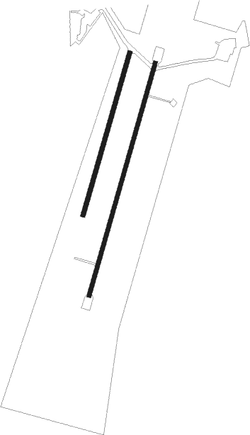
Runway info
Runway 18 / 36  | ||
| length | 1043m (3422ft) | |
| bearing | 221° / 41° | |
| width | 18m (60ft) | |
| surface | gravel | |
| Runway 02 / 20 | ||
| length | 726m (2382ft) | |
| bearing | 42° / 222° | |
| width | 19m (63ft) | |
| surface | dirt | |
| Runway 04 / 22 | ||
| length | 517m (1696ft) | |
| bearing | 68° / 248° | |
| width | 8m (26ft) | |
| surface | dirt | |
Instrument approach procedures
| runway | airway (heading) | route (dist, bearing) |
|---|---|---|
| RW18 | HOBOM (264°) | HOBOM SHUNT (17mi, 270°) 3000ft |
| RNAV | SHUNT 3000ft JODOG (7mi, 261°) 2600ft ENEBE (1mi, 244°) 2100ft MOKIE (4mi, 244°) 593ft (6703mi, 113°) 675ft OLSEE (6719mi, 293°) 4400ft OLSEE (turn) | |
| RW36 | OLSEE (337°) | OLSEE SPLAY (16mi, 293°) 2800ft |
| RW36 | TADUE (84°) | TADUE SPLAY (16mi, 95°) 2800ft |
| RNAV | SPLAY 2800ft HIKAT (6mi, 63°) 2100ft DAFTY (3mi, 63°) 1200ft FIRBI (2mi, 63°) 537ft (6705mi, 113°) 675ft OLSEE (6719mi, 293°) 4400ft OLSEE (turn) |
Disclaimer
The information on this website is not for real aviation. Use this data with the X-Plane flight simulator only! Data taken with kind consent from X-Plane 12 source code and data files. Content is subject to change without notice.