Anchorage - Merrill Field
Airport details
| Country | United States of America |
| State | Alaska |
| Region | PA |
| Municipality | Anchorage |
| Elevation | 136ft (41m) |
| Timezone | GMT -9 |
| Coordinates | 61.21355, -149.84473 |
| Magnetic var | |
| Type | land |
| Available since | X-Plane v10.40 |
| ICAO code | PAMR |
| IATA code | MRI |
| FAA code | MRI |
Communication
| Merrill Field ATIS | 124.250 |
| Merrill Field UNICOM | 122.950 |
| Merrill Field CTAF | 126.000 |
| Merrill Field GROUND | 121.700 |
| Merrill Field TOWER | 126.000 |
| Merrill Field ANCHORAGE Approach | 119.100 |
| Merrill Field ANCHORAGE Departure | 119.100 |
Nearby Points of Interest:
Pioneer School House
-Wendler Building
-McKinley Tower Apartments
-United States Federal Building and Courthouse
-Leopold David House
-A. E. C. Cottage No. 23
-Alaska Engineering Commission Cottage No. 25
-Civil Works Residential Dwellings
-Tony Knowles Coastal Trail
-Oscar Anderson House Museum
-Oscar Gill House
-Atwood Campus Center
-KENI Radio Building
-Pilgrim 100-B N709Y
-Site Summit
-Potter Section House
-Beluga Point Site
-Spring Creek Lodge
-Hope Historic District
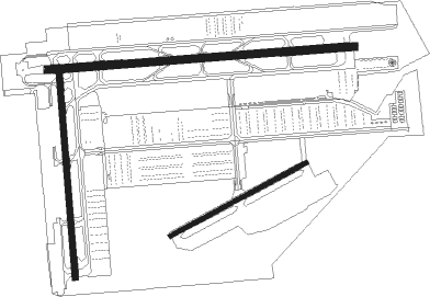
Runway info
Runway 7 / 25  | ||
| length | 1214m (3983ft) | |
| bearing | 90° / 270° | |
| width | 30m (100ft) | |
| surface | asphalt | |
| blast zone | 23m (75ft) / 22m (72ft) | |
| Runway 16 / 34 | ||
| length | 803m (2635ft) | |
| bearing | 180° / 0° | |
| width | 23m (75ft) | |
| surface | asphalt | |
| blast zone | 0m (0ft) / 16m (52ft) | |
| Runway 05 / 23 | ||
| length | 611m (2005ft) | |
| bearing | 78° / 258° | |
| width | 18m (60ft) | |
| surface | gravel | |
Nearby beacons
| code | identifier | dist | bearing | frequency |
|---|---|---|---|---|
| EDF | ELMENDORF (ANCHORAGE) TACAN | 3.3 | 61° | 113.40 |
| TED | ANCHORAGE VOR/DME | 4.3 | 248° | 113.15 |
| BGQ | BIG LAKE VORTAC | 21.6 | 341° | 112.50 |
Disclaimer
The information on this website is not for real aviation. Use this data with the X-Plane flight simulator only! Data taken with kind consent from X-Plane 12 source code and data files. Content is subject to change without notice.