Northway
Airport details
| Country | United States of America |
| State | Alaska |
| Region | PA |
| Municipality | Unorganized Borough |
| Elevation | 1720ft (524m) |
| Timezone | GMT -9 |
| Coordinates | 62.96117, -141.92809 |
| Magnetic var | |
| Type | land |
| Available since | X-Plane v10.40 |
| ICAO code | PAOR |
| IATA code | ORT |
| FAA code | ORT |
Communication
| Northway ASOS | 135.400 |
| Northway CTAF | 123.600 |
Runway info
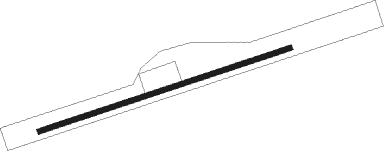
| Runway 5 / 23 | ||
| length | 1547m (5075ft) | |
| bearing | 84° / 264° | |
| width | 30m (100ft) | |
| surface | asphalt | |
| blast zone | 194m (636ft) / 255m (837ft) | |
Nearby beacons
| code | identifier | dist | bearing | frequency |
|---|---|---|---|---|
| AES | NABESNA (NORTHWAY) NDB | 0.8 | 123° | 390 |
| ORT | NORTHWAY VORTAC | 0.9 | 132° | 116.30 |
Instrument approach procedures
| runway | airway (heading) | route (dist, bearing) |
|---|---|---|
| RW05 | HUMEB (89°) | HUMEB 8300ft IYANE (5mi, 150°) 8300ft KOKDE (6mi, 83°) 6700ft |
| RW05 | IYANE (83°) | IYANE 8300ft KOKDE (6mi, 83°) 6700ft |
| RW05 | SIVAE (77°) | SIVAE 8300ft IYANE (5mi, 330°) 8300ft KOKDE (6mi, 83°) 6700ft |
| RNAV | KOKDE 6700ft LUYIP (6mi, 83°) 5000ft WEGOL (4mi, 83°) 3580ft ZUPAL (5mi, 84°) 1923ft ECAYI (4mi, 84°) UVUTE (13mi, 94°) 4700ft UVUTE (turn) | |
| RW23 | CIMGO (106°) | CIMGO NICIP (28mi, 95°) 5800ft NICIP (turn) 4900ft |
| RW23 | JUTBU (77°) | JUTBU YEDNU (45mi, 92°) 9600ft WIRIS (16mi, 12°) 5200ft NICIP (7mi, 305°) 4900ft |
| RNAV | NICIP 4900ft HUBOM (7mi, 264°) 4000ft ZODEL (4mi, 264°) 2660ft PAOR (3mi, 264°) 1755ft (6665mi, 114°) 2115ft IKUXE (6670mi, 294°) 8000ft CIMGO (13mi, 301°) 8000ft CIMGO (turn) |
Disclaimer
The information on this website is not for real aviation. Use this data with the X-Plane flight simulator only! Data taken with kind consent from X-Plane 12 source code and data files. Content is subject to change without notice.