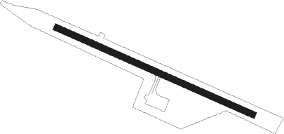
St George
Airport details
| Country | United States of America |
| State | Alaska |
| Region | PA |
| Municipality | Unorganized Borough |
| Elevation | 125ft (38m) |
| Timezone | GMT -9 |
| Coordinates | 56.57736, -169.66373 |
| Magnetic var | |
| Type | land |
| Available since | X-Plane v10.40 |
| ICAO code | PAPB |
| IATA code | STG |
| FAA code | PBV |
Communication
| St George ASOS | 135.450 |
| St George CTAF | 122.800 |
| St George Approach/Dep Anchorage | 119.100 |
Approach frequencies
| ILS-cat-I | RW11 | 110.1 | 18.00mi |
| 3.6° GS | RW11 | 110.1 | 18.00mi |
Nearby beacons
| code | identifier | dist | bearing | frequency |
|---|---|---|---|---|
| SRI | (ST. GEORGE) DME | 0.5 | 108° | 114.90 |
| SRI | PRIBILOF (ST. GEORGE) NDB | 0.6 | 109° | 399 |
| SPY | PAUL ISLAND DME-ILS | 39.5 | 316° | 109.90 |
Instrument approach procedures
| runway | airway (heading) | route (dist, bearing) |
|---|---|---|
| RW11 | EQQUP (106°) | EQQUP 3000ft |
| RW11 | JIRON (137°) | JIRON EQQUP (8mi, 224°) 3000ft |
| RW11 | OSUCA (86°) | OSUCA EQQUP (8mi, 44°) 3000ft |
| RNAV | EQQUP 3000ft APOTE (6mi, 106°) 2100ft WIVOG (3mi, 106°) 1060ft PAPB (3mi, 107°) 184ft (7376mi, 108°) 600ft OSUCA (7380mi, 288°) 3000ft OSUCA (turn) | |
| RWNVD | BILBE (276°) | BILBE HEKEL (132mi, 275°) 2000ft HEKEL (turn) 2000ft |
| RWNVD | DIBWO (299°) | DIBWO HEKEL (29mi, 284°) 2000ft HEKEL (turn) 2000ft |
| RWNVD | SPY (136°) | SPY HEKEL (38mi, 162°) 2100ft HEKEL (turn) 2000ft |
| RNAV | HEKEL 2000ft AJBOS (6mi, 82°) 1600ft JEJZO (4mi, 82°) 980ft (7376mi, 108°) 980ft HEKEL (7381mi, 288°) 2100ft HEKEL (turn) |
Disclaimer
The information on this website is not for real aviation. Use this data with the X-Plane flight simulator only! Data taken with kind consent from X-Plane 12 source code and data files. Content is subject to change without notice.
