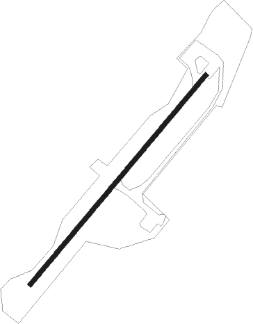
Arctic Village
Airport details
| Country | United States of America |
| State | Alaska |
| Region | PA |
| Municipality | Unorganized Borough |
| Elevation | 2083ft (635m) |
| Timezone | GMT -9 |
| Coordinates | 68.11467, -145.57942 |
| Magnetic var | |
| Type | land |
| Available since | X-Plane v11.51r1 |
| ICAO code | PARC |
| IATA code | ARC |
| FAA code | ARC |
Communication
| Arctic Village AWOS | 135.750 |
| Arctic Village ARCTIC_VILLAGE MULT | 122.900 |
Runway info
| Runway 02 / 20 | ||
| length | 1369m (4491ft) | |
| bearing | 69° / 249° | |
| width | 23m (75ft) | |
| surface | gravel | |
Departure and arrival routes
| Transition altitude | 18000ft |
| Transition level | 18000ft |
| SID end points | distance | outbound heading | |
|---|---|---|---|
| RW02 | |||
| TUVVO1 | 32mi | 225° | |
| RW20 | |||
| TUVVO1 | 32mi | 225° | |
Instrument approach procedures
| runway | airway (heading) | route (dist, bearing) |
|---|---|---|
| RW02 | TUVVO (45°) | TUVVO DUCEK (18mi, 1°) 7000ft ECADU (5mi, 68°) 5500ft |
| RNAV | ECADU 5500ft RIYON (3mi, 68°) 4500ft CODIV (4mi, 68°) 3300ft DEGEC (3mi, 69°) 2171ft (6481mi, 115°) 2492ft FIPNU (6476mi, 295°) HULIS (14mi, 97°) TUVVO (40mi, 249°) 10000ft TUVVO (turn) | |
| RW20 | JEKPU (67°) | JEKPU SOCBO (43mi, 71°) 10800ft FAXEK (7mi, 282°) 7500ft DIPYE (6mi, 237°) 5700ft |
| RW20 | OMEDE (360°) | OMEDE SOCBO (82mi, 28°) 10800ft FAXEK (7mi, 282°) 7500ft DIPYE (6mi, 237°) 5700ft |
| RNAV | DIPYE 5700ft CIRAY (4mi, 237°) 4500ft ETOCU (4mi, 246°) 3200ft HONIL (3mi, 246°) 2186ft (6480mi, 115°) 2492ft ILAVE (6482mi, 295°) JEKPU (22mi, 247°) 10000ft JEKPU (turn) |
Disclaimer
The information on this website is not for real aviation. Use this data with the X-Plane flight simulator only! Data taken with kind consent from X-Plane 12 source code and data files. Content is subject to change without notice.
