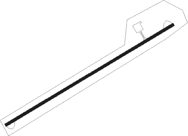
Shishmaref
Airport details
| Country | United States of America |
| State | Alaska |
| Region | PA |
| Municipality | Shishmaref |
| Elevation | 12ft (4m) |
| Timezone | GMT -9 |
| Coordinates | 66.24958, -166.08936 |
| Magnetic var | |
| Type | land |
| Available since | X-Plane v10.40 |
| ICAO code | PASH |
| IATA code | SHH |
| FAA code | SHH |
Communication
| Shishmaref AWOS 3 | 121.100 |
| Shishmaref CTAF | 123.000 |
Runway info
| Runway 5 / 23 | ||
| length | 1516m (4974ft) | |
| bearing | 79° / 259° | |
| width | 21m (69ft) | |
| surface | asphalt | |
Nearby beacons
| code | identifier | dist | bearing | frequency |
|---|---|---|---|---|
| SHH | SHISHMAREF NDB | 1 | 77° | 365 |
Instrument approach procedures
| runway | airway (heading) | route (dist, bearing) |
|---|---|---|
| RW05 | TITOC (79°) | TITOC 2500ft |
| RW05 | UGIPE (64°) | UGIPE 2500ft TITOC (5mi, 309°) 2500ft |
| RW05 | VIGGU (89°) | VIGGU 2500ft TITOC (5mi, 129°) 2500ft |
| RNAV | TITOC 2500ft ROSOC (6mi, 78°) 1600ft PASH (5mi, 79°) 59ft (6787mi, 112°) 300ft SIPOC (6780mi, 292°) 2500ft SIPOC (turn) | |
| RW23 | SIPOC (259°) | SIPOC 2500ft |
| RW23 | YOTUK (269°) | YOTUK 2500ft SIPOC (5mi, 309°) 2500ft |
| RW23 | ZIROD (244°) | ZIROD 2500ft SIPOC (5mi, 129°) 2500ft |
| RNAV | SIPOC 2500ft WOPIG (6mi, 259°) 1600ft PASH (5mi, 259°) 58ft (6787mi, 112°) 380ft TITOC (6795mi, 292°) 2500ft TITOC (turn) |
Disclaimer
The information on this website is not for real aviation. Use this data with the X-Plane flight simulator only! Data taken with kind consent from X-Plane 12 source code and data files. Content is subject to change without notice.
