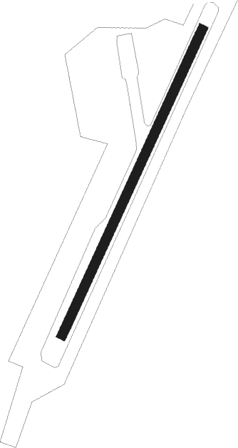
Elim
Airport details
| Country | United States of America |
| State | Alaska |
| Region | PA |
| Municipality | Elim |
| Elevation | 160ft (49m) |
| Timezone | GMT -9 |
| Coordinates | 64.61497, -162.27052 |
| Magnetic var | |
| Type | land |
| Available since | X-Plane v10.40 |
| ICAO code | PFEL |
| IATA code | ELI |
| FAA code | ELI |
Communication
Runway info
| Runway 01 / 19 | ||
| length | 1041m (3415ft) | |
| bearing | 52° / 232° | |
| width | 30m (98ft) | |
| surface | gravel | |
Nearby beacons
| code | identifier | dist | bearing | frequency |
|---|---|---|---|---|
| MOS | MOSES POINT (ELIM) VOR/DME | 7 | 68° | 116.30 |
| OAY | NORTON BAY (MOSES PT) NDB | 7.1 | 69° | 263 |
Instrument approach procedures
| runway | airway (heading) | route (dist, bearing) |
|---|---|---|
| RW01 | DIYAG (28°) | DIYAG 4300ft WUGAT (5mi, 283°) 4000ft AHCUJ (5mi, 52°) 3300ft |
| RW01 | ONABE (67°) | ONABE 4500ft WUGAT (5mi, 103°) 4000ft AHCUJ (5mi, 52°) 3300ft |
| RW01 | WUGAT (52°) | WUGAT 4000ft AHCUJ (5mi, 52°) 3300ft |
| RNAV | AHCUJ 3300ft COGNI (5mi, 52°) 2500ft PFEL (7mi, 52°) 202ft AJABU (6mi, 53°) BIYIR (9mi, 53°) 5000ft BIYIR (turn) | |
| RW19 | AVGIY (249°) | AVGIY 5000ft BIYIR (5mi, 284°) 5000ft |
| RW19 | BIYIR (233°) | BIYIR 5000ft |
| RW19 | CISAS (202°) | CISAS 5600ft BIYIR (5mi, 103°) 5000ft |
| RNAV | BIYIR 5000ft AJABU (9mi, 233°) 2200ft PFEL (6mi, 233°) 163ft (6853mi, 112°) 562ft WUGAT (6870mi, 292°) 4000ft WUGAT (turn) |
Disclaimer
The information on this website is not for real aviation. Use this data with the X-Plane flight simulator only! Data taken with kind consent from X-Plane 12 source code and data files. Content is subject to change without notice.
