Shaktoolik - Shaktoolik New
Airport details
| Country | United States of America |
| State | Alaska |
| Region | PA |
| Municipality | Shaktoolik |
| Elevation | 22ft (7m) |
| Timezone | GMT -9 |
| Coordinates | 64.37109, -161.22397 |
| Magnetic var | |
| Type | land |
| Available since | X-Plane v10.40 |
| ICAO code | PFSH |
| IATA code | SKK |
| FAA code | 2C7 |
Communication
| Shaktoolik New AWOS-3 | 121.550 |
| Shaktoolik New CTAF | 122.800 |
| Shaktoolik New Anchorage ARTCC | 135.700 |
Nearby Points of Interest:
Iyatayet Site
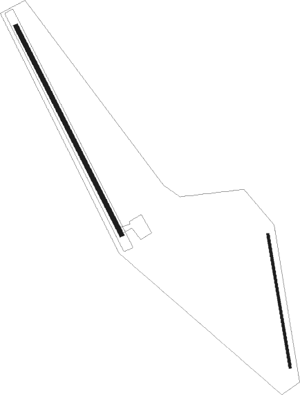
Runway info
Runway 14 / 32  | ||
| length | 1221m (4006ft) | |
| bearing | 136° / 316° | |
| width | 23m (75ft) | |
| surface | gravel | |
| Runway 15 / 33 | ||
| length | 703m (2306ft) | |
| bearing | 168° / 348° | |
| width | 13m (43ft) | |
| surface | dirt | |
Nearby beacons
| code | identifier | dist | bearing | frequency |
|---|---|---|---|---|
| OAY | NORTON BAY (MOSES PT) NDB | 29.1 | 291° | 263 |
| MOS | MOSES POINT (ELIM) VOR/DME | 29.3 | 291° | 116.30 |
| JNR | NORTH RIVER (UNALAKLEET) NDB | 29.8 | 138° | 382 |
| UNK | UNALAKLEET VOR/DME | 32 | 132° | 116.90 |
| KKA | KOYUK NDB | 33.9 | 7° | 299 |
Instrument approach procedures
| runway | airway (heading) | route (dist, bearing) |
|---|---|---|
| RW15 | ISOTE (107°) | ISOTE MEALT (9mi, 80°) 3000ft |
| RW15 | JITUR (203°) | JITUR MEALT (9mi, 260°) 3000ft |
| RW15 | MEALT (136°) | MEALT 3000ft |
| RNAV | MEALT 3000ft SEBKY (6mi, 136°) 2500ft DIEGG (5mi, 136°) 840ft PFSH (3mi, 137°) 59ft (6857mi, 112°) 271ft FANUB (6866mi, 292°) 3500ft FANUB (turn) 3500ft | |
| RW33 | FANUB (317°) | FANUB 3500ft |
| RW33 | HEBDU (286°) | HEBDU FANUB (9mi, 260°) 3500ft |
| RW33 | WOLIG (28°) | WOLIG FANUB (9mi, 80°) 3500ft |
| RNAV | FANUB 3500ft PARZY (6mi, 317°) 2000ft PFSH (6mi, 317°) 64ft (6857mi, 112°) 274ft MEALT (6847mi, 292°) 3000ft MEALT (turn) |
Disclaimer
The information on this website is not for real aviation. Use this data with the X-Plane flight simulator only! Data taken with kind consent from X-Plane 12 source code and data files. Content is subject to change without notice.