Kahului
Airport details
| Country | United States of America |
| State | Hawaii |
| Region | PH |
| Airspace | Honolulu Control Facility Ctr |
| Municipality | Kahului |
| Elevation | 54ft (16m) |
| Timezone | GMT -10 |
| Coordinates | 20.88901, -156.43387 |
| Magnetic var | |
| Type | land |
| Available since | X-Plane v10.40 |
| ICAO code | PHOG |
| IATA code | OGG |
| FAA code | OGG |
Communication
| Kahului ATIS | 128.600 |
| Kahului CTAF | 118.700 |
| Kahului UNICOM | 122.950 |
| Kahului MAUI Clearance DEL | 120.600 |
| Kahului Ground Control | 121.900 |
| Kahului MAUI Tower | 118.700 |
| Kahului MAUI Approach/Departure | 119.500 |
| Kahului MAUI Approach/Departure | 120.200 |
Approach frequencies
| ILS-cat-I | RW02 | 110.1 | 18.00mi |
| 3° GS | RW02 | 110.1 | 18.00mi |
Nearby Points of Interest:
Kanaha Pond State Wildlife Sanctuary
-Puunene School
-Kaahumanu Church
-Wailuku Civic Center Historic District
-Wailuku School
-Chee Kung Tong Society Building
-Makawao Union Church
-Fred C. Baldwin Memorial Home
-Waihee Church
-Kalepolepo Fishpond
-Hana Highway
-Lahainaluna High School
-Mokuʻula
-Wo Hing Society Hall
-Crater Historic District
-Pu'upehe Platform
-Lanai City
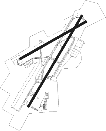
Runway info
Runway 2 / 20  | ||
| length | 2140m (7021ft) | |
| bearing | 37° / 217° | |
| width | 46m (150ft) | |
| surface | asphalt | |
| blast zone | 66m (217ft) / 120m (394ft) | |
| Runway 5 / 23 | ||
| length | 1520m (4987ft) | |
| bearing | 66° / 246° | |
| width | 46m (150ft) | |
| surface | asphalt | |
| blast zone | 183m (600ft) / 0m (0ft) | |
Nearby beacons
| code | identifier | dist | bearing | frequency |
|---|---|---|---|---|
| VYI | VALLEY ISLAND (KAHULUI) NDB | 0.6 | 227° | 327 |
| OGG | MAUI (KAHULUI) VORTAC | 1.2 | 37° | 115.10 |
| LNY | LANAI (LANAI CITY) VORTAC | 30.9 | 257° | 117.70 |
| LLD | LANAI NDB | 31 | 258° | 353 |
| MKK | MOLOKAI (KAUNAKAKAI) VORTAC | 43.7 | 289° | 116.10 |
| UPP | UPOLU POINT (HAWI) VORTAC | 53 | 139° | 112.30 |
| MUE | KAMUELA VOR/DME | 68.6 | 139° | 113.30 |
Departure and arrival routes
| Transition altitude | 18000ft |
| Transition level | 18000ft |
| SID end points | distance | outbound heading | |
|---|---|---|---|
| RW02 | |||
| SWEEP2 | 25mi | 79° | |
| ONOHI2 | 26mi | 94° | |
| BEACH4 | 31mi | 257° | |
| NPLII2 | 59mi | 272° | |
| RW05 | |||
| SWEEP2 | 25mi | 79° | |
| ONOHI2 | 26mi | 94° | |
| BEACH4 | 31mi | 257° | |
| RW20 | |||
| SWEEP2 | 25mi | 79° | |
| ONOHI2 | 26mi | 94° | |
| BEACH4 | 31mi | 257° | |
| RW23 | |||
| BEACH4 | 31mi | 257° | |
| STAR starting points | distance | inbound heading | |
|---|---|---|---|
| ALL | |||
| CAMPS3 | 16.4 | 37° | |
| LNDHY1 | 24.3 | 227° | |
| LAVAS1 | 23.9 | 358° | |
Instrument approach procedures
| runway | airway (heading) | route (dist, bearing) |
|---|---|---|
| RW02-Y | GREHG (15°) | GREHG WUNAT (8mi, 345°) 3200ft |
| RW02-Y | HOMAI (268°) | HOMAI ZETMA (6mi, 217°) 4500ft CORBU (8mi, 217°) 3500ft WUNAT (4mi, 303°) 3200ft |
| RW02-Y | KEIKI (50°) | KEIKI WUNAT (8mi, 67°) 3200ft |
| RNAV | WUNAT 3200ft SABAE (3mi, 37°) 2600ft JINAS (4mi, 37°) 1400ft PHOG (4mi, 38°) 115ft (8943mi, 98°) 454ft KRANE (8929mi, 278°) 3000ft KRANE (turn) | |
| RW02-Z | GREHG (15°) | GREHG 6000ft ZOXUP (7mi, 323°) 4500ft JOPOB (8mi, 37°) 1600ft WASBA (2mi, 37°) 1200ft |
| RW02-Z | HOMAI (268°) | HOMAI 5000ft KAWLA (3mi, 217°) 4100ft ZORTI (3mi, 216°) 3200ft WOREK (4mi, 261°) 1800ft WASBA (3mi, 350°) 1200ft |
| RW02-Z | KEIKI (50°) | KEIKI 5000ft ZOXUP (6mi, 83°) 4500ft JOPOB (8mi, 37°) 1600ft WASBA (2mi, 37°) 1200ft |
| RNAV | WASBA 1200ft PHOG (3mi, 39°) 117ft (8943mi, 98°) 349ft KRANE (8929mi, 278°) 3000ft KRANE (turn) | |
| RW20 | PLUMB (153°) | PLUMB FOSLU (11mi, 126°) 3000ft WEPTU (8mi, 126°) 2000ft |
| RW20 | SWEEP (259°) | SWEEP POCGI (11mi, 277°) 3000ft WEPTU (8mi, 277°) 2000ft |
| RNAV | WEPTU 2000ft JUDEZ (3mi, 217°) 1700ft BIKDE (2mi, 217°) 940ft HUKLA (3mi, 217°) 133ft (8942mi, 98°) 500ft NDREW (8962mi, 277°) 4300ft NDREW (turn) | |
| RW23 | PLUMB (153°) | PLUMB ZULUD (11mi, 114°) 4000ft FOGOL (10mi, 114°) 4000ft MOBRE (5mi, 154°) 2700ft |
| RW23 | RABAT (275°) | RABAT BARBY (26mi, 276°) 7000ft MOBRE (16mi, 296°) 2700ft |
| RW23 | SARDS (296°) | SARDS BARBY (25mi, 319°) 7000ft MOBRE (16mi, 296°) 2700ft |
| RNAV | MOBRE 2700ft HEDAT (6mi, 246°) 1900ft IMEBE (2mi, 246°) 1200ft PHOG (4mi, 239°) 65ft (8943mi, 98°) 454ft ZULUD (8933mi, 278°) 4000ft ZULUD (turn) |
Holding patterns
| STAR name | hold at | type | turn | heading* | altitude | leg | speed limit |
|---|---|---|---|---|---|---|---|
| CAMPS3 | CAMPS | VHF | left | 275 (95)° | < 60000ft | 1.0min timed | ICAO rules |
| *) magnetic outbound (inbound) holding course | |||||||
Disclaimer
The information on this website is not for real aviation. Use this data with the X-Plane flight simulator only! Data taken with kind consent from X-Plane 12 source code and data files. Content is subject to change without notice.