Vieques - Camp Garcia Vieques
Airport details
| Country | United States of America |
| State | Puerto Rico |
| Region | |
| Airspace | San Juan Oceanic Ctr |
| Municipality | Vieques |
| Elevation | 42ft (13m) |
| Timezone | GMT -4 |
| Coordinates | 18.11616, -65.42847 |
| Magnetic var | |
| Type | land |
| Available since | X-Plane v10.40 |
| ICAO code | PR18 |
| IATA code | n/a |
| FAA code | n/a |
Communication
Nearby Points of Interest:
United States Customs House
-Santiago Apóstol Cathedral
-Casa Roig Museum
-Estate Brewers Bay
-Hamburg-America Shipping Line Administrative Offices
-Legislature Building
-Charlotte Amalie Historic District
-New Herrnhut Moravian Church
-Lind Point Fort
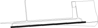
Runway info
| Runway 09 / 27 | ||
| length | 1578m (5177ft) | |
| bearing | 91° / 271° | |
| width | 30m (100ft) | |
| surface | dirt | |
Nearby beacons
| code | identifier | dist | bearing | frequency |
|---|---|---|---|---|
| STT | SAINT THOMAS VOR/DME | 27.1 | 59° | 108.60 |
| SJU | SAN JUAN VORTAC | 37.6 | 300° | 114 |
| ST | PESTE (CHRISTIANSTED) NDB | 40.1 | 128° | 241 |
| SJ | PATTY (SAN JUAN) NDB | 41.6 | 294° | 330 |
| COY | SAINT CROIX VOR/DME | 47.4 | 118° | 108.20 |
| DDP | DORADO (SAN JUAN) NDB | 59.9 | 290° | 391 |
Disclaimer
The information on this website is not for real aviation. Use this data with the X-Plane flight simulator only! Data taken with kind consent from X-Plane 12 source code and data files. Content is subject to change without notice.