Mountainair - Mountainair Muni
Airport details
| Country | United States of America |
| State | New Mexico |
| Region | |
| Airspace | Albuquerque Ctr |
| Municipality | Torrance County |
| Elevation | 6492ft (1979m) |
| Timezone | GMT -7 |
| Coordinates | 34.53167, -106.23068 |
| Magnetic var | |
| Type | land |
| Available since | X-Plane v10.40 |
| ICAO code | Q04 |
| IATA code | n/a |
| FAA code | M10 |
Communication
| Mountainair Muni CTAF | 122.900 |
Nearby Points of Interest:
Mountainair Municipal Auditorium
-Gran Quivera Historic District
-El Cerro Tome Site
-Belen Harvey House
-Tome Jail
-Belen City Hall
-Moriarty Eclipse Windmill
-Atchison, Topeka, and Santa Fe Railroad Depot
-Otero's 66 Service
-Isleta Pueblo
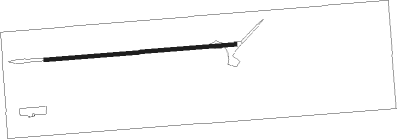
Runway info
| Runway 08 / 26 | ||
| length | 786m (2579ft) | |
| bearing | 90° / 270° | |
| width | 15m (50ft) | |
| surface | dirt | |
Nearby beacons
| code | identifier | dist | bearing | frequency |
|---|---|---|---|---|
| CNX | CORONA VORTAC | 29.1 | 107° | 115.50 |
| BRG | DME | 30.6 | 281° | 114.75 |
| ONM | SOCORRO VORTAC | 31.4 | 252° | 116.80 |
| OTO | OTTO VOR | 35.5 | 29° | 114 |
| ABQ | ALBUQUERQUE VORTAC | 42.1 | 311° | 113.20 |
| AE | DUDLE (ALBUQUERQUE) NDB | 47.5 | 325° | 351 |
Disclaimer
The information on this website is not for real aviation. Use this data with the X-Plane flight simulator only! Data taken with kind consent from X-Plane 12 source code and data files. Content is subject to change without notice.