Longtan Township - Longtan
Airport details
| Country | Taiwan |
| State | Taoyuan County |
| Region | RC |
| Airspace | Taipei Ctr |
| Municipality | Taoyuan City |
| Elevation | 790ft (241m) |
| Timezone | GMT +8 |
| Coordinates | 24.85788, 121.23856 |
| Magnetic var | |
| Type | land |
| Available since | X-Plane v10.40 |
| ICAO code | RCDI |
| IATA code | n/a |
| FAA code | n/a |
Communication
| Longtan Tower | 135.300 |
Nearby Points of Interest:
Sanxia Zaishu Temple
-Sanxia Arch Bridge
-Hsinchu Jinshan Temple
-Hsinchu Municipal Government Hall
-the Tomb of Zheng Yong-xi
-Wugu XiYun temple
-Red Building of Taipei Municipal Jianguo High School
-Yen Chia-Kan's Residence
-Judicial Yuan Building
-Li Family Abode
-Tianmei Yonghe Temple
-National Taiwan University Hospital
-Control Yuan
-Jingmei Fusing Temple
-Ren'an Hospital
-Qidong Street Japanese Houses
-Former Dadaocheng Substation
-Taiwan New Cultural Movement Memorial Hall
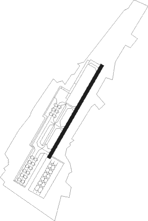
Runway info
| Runway 04 / 22 | ||
| length | 1002m (3287ft) | |
| bearing | 37° / 217° | |
| width | 30m (100ft) | |
| surface | concrete | |
Nearby beacons
| code | identifier | dist | bearing | frequency |
|---|---|---|---|---|
| RA | LUNGTANG NDB | 0.8 | 76° | 202 |
| TYN | TAOYUAN TACAN | 12.2 | 2° | 115.80 |
| HSU | HSINCHU TACAN | 16.5 | 263° | 116.30 |
| SG | SONGSHAN (TAIPEI) NDB | 20.3 | 54° | 310 |
| TSI | SONGSHAN (TAIPEI) VOR/DME | 21.7 | 57° | 113.50 |
| AP | ANBU NDB | 24.5 | 42° | 250 |
| APU | ANBU (TAIPEI) VOR/DME | 24.6 | 42° | 112.50 |
| HL | HOULONG NDB | 32.8 | 240° | 362 |
| HLG | HOULONG VOR/DME | 33.1 | 240° | 114 |
| LU | KEELUNG NDB | 34.9 | 63° | 357 |
| WK | HSINSHIE NDB | 43.8 | 214° | 340 |
| CCK | CINGCYUANGANG TACAN | 49.2 | 226° | 111.30 |
| TC | CINGCYUANGANG (TAICHUNG) NDB | 49.6 | 226° | 210 |
| TCK | (TAICHUNG) DME | 49.6 | 226° | 108.40 |
| YU | HUALIEN NDB | 54.7 | 155° | 380 |
| HLN | HUALIEN VOR/DME | 54.9 | 154° | 114.10 |
Disclaimer
The information on this website is not for real aviation. Use this data with the X-Plane flight simulator only! Data taken with kind consent from X-Plane 12 source code and data files. Content is subject to change without notice.