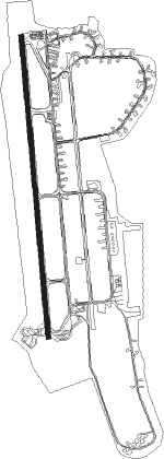
Chiayi City - Chiayi
Airport details
| Country | Taiwan |
| State | Chiayi County |
| Region | RC |
| Airspace | Taipei Ctr |
| Municipality | Shuishang Township |
| Elevation | 83ft (25m) |
| Timezone | GMT +8 |
| Coordinates | 23.45654, 120.39435 |
| Magnetic var | |
| Type | land |
| Available since | X-Plane v10.40 |
| ICAO code | RCKU |
| IATA code | CYI |
| FAA code | n/a |
Communication
| CHIAYI CHIAYI TOWER | 122.700 |
| CHIAYI CHIAYI TOWER | 118.600 |
| CHIAYI KAOHSIUNG ApproachROACH | 120.600 |
Approach frequencies
| ILS-cat-I | RW36 | 109.9 | 18.00mi |
| ILS-cat-I | RW18 | 110.3 | 18.00mi |
| 3° GS | RW36 | 109.9 | 18.00mi |
| 3° GS | RW18 | 110.3 | 18.00mi |
Nearby Points of Interest:
Chaotian Temple
-Wanguo Theater
-Hilltop Garden Watercourse Museum
-Kaiyuan Temple
-Sihcao Wetlands
-Ta Kuan-Yin Ting and Hsin-Chi Kung
-Kaiji lingyou Temple
-Jingfu Shrine
-Hayashi Department Store
Nearby beacons
| code | identifier | dist | bearing | frequency |
|---|---|---|---|---|
| KU | CHIAYI NDB | 7.6 | 358° | 525 |
| TNN | SIGANG (TAINAN) VOR/DME | 21.9 | 210° | 113.30 |
| NN | SIGANG (TAINAN) NDB | 22.5 | 210° | 375 |
| MR | KUEIJEN NDB | 29.2 | 192° | 312 |
| AY | KANGSHAN NDB | 36.8 | 192° | 265 |
| BM | MAGONG NDB | 42.5 | 280° | 290 |
| MKG | MAGONG (PENGHU I.) VOR/DME | 42.5 | 280° | 115.20 |
| DC | PINGTUNG NDB | 47.1 | 178° | 215 |
| PIT | PINGTUNG TACAN | 47.3 | 175° | 109.60 |
| TC | CINGCYUANGANG (TAICHUNG) NDB | 49.4 | 16° | 210 |
| TCK | (TAICHUNG) DME | 49.4 | 16° | 108.40 |
| CCK | CINGCYUANGANG TACAN | 49.9 | 15° | 111.30 |
| WK | HSINSHIE NDB | 52.2 | 29° | 340 |
| SK | KAOHSIUNG INTL NDB | 52.9 | 184° | 330 |
| MFNN | (TAITUNG) DME-ILS | 57.2 | 135° | 110.90 |
| TTG | TAITUNG TACAN | 58.7 | 130° | 113.80 |
| JB | JHIHBEN (TAITUNG) NDB | 59.2 | 137° | 325 |
| JBT | (TAITUNG) DME | 59.2 | 137° | 108.20 |
| ZN | TAITUNG NDB | 59.4 | 132° | 430 |
Departure and arrival routes
| Transition altitude | 11000ft |
| Transition level | 13000ft |
| SID end points | distance | outbound heading | |
|---|---|---|---|
| RW18 | |||
| HOUPI1 | 28mi | 12° | |
| PAIHO1 | 22mi | 210° | |
| RW36 | |||
| HOUPI1 | 28mi | 12° | |
| TAIPO1 | 22mi | 210° | |
Instrument approach procedures
| runway | airway (heading) | route (dist, bearing) |
|---|---|---|
| RW18 | HSILO (179°) | HSILO 4000ft HUWEI (6mi, 179°) 3000ft |
| RW18 | TAISI (151°) | TAISI 4000ft HUWEI (6mi, 89°) 3000ft |
| RNAV | HUWEI 3000ft PEKAN (6mi, 179°) 1720ft RCKU (6mi, 177°) 125ft RCKU (turn) 500ft TAISI (14mi, 331°) 4000ft TAISI (turn) 4000ft | |
| RW36 | POTZU (30°) | POTZU 4000ft KUANZ (6mi, 89°) 3000ft |
| RW36 | WUSAN (0°) | WUSAN 4000ft KUANZ (6mi, 359°) 3000ft |
| RNAV | KUANZ 3000ft WUFON (6mi, 359°) 1730ft RCKU (5mi, 2°) 135ft RCKU (turn) 600ft POTZU (13mi, 210°) 4000ft POTZU (turn) 4000ft |
Disclaimer
The information on this website is not for real aviation. Use this data with the X-Plane flight simulator only! Data taken with kind consent from X-Plane 12 source code and data files. Content is subject to change without notice.
