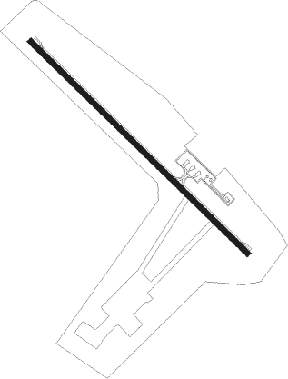
Hengchung - Hengchun
Airport details
| Country | Taiwan |
| State | Pingtung County |
| Region | RC |
| Airspace | Taipei Ctr |
| Municipality | Hengchun |
| Elevation | 44ft (13m) |
| Timezone | GMT +8 |
| Coordinates | 22.03819, 120.73486 |
| Magnetic var | |
| Type | land |
| Available since | X-Plane v10.40 |
| ICAO code | RCKW |
| IATA code | HCN |
| FAA code | n/a |
Communication
| HENGCHUN HENGCHUN TOWER | 118.250 |
| HENGCHUN HENGCHUN TOWER | 121.500 |
| HENGCHUN HENGCHUN TOWER | 236.600 |
| HENGCHUN HENGCHUN TOWER | 243.000 |
| HENGCHUN KAOHSIUNG ApproachROACH | 121.100 |
| HENGCHUN KAOHSIUNG ApproachROACH | 124.700 |
Nearby Points of Interest:
Old House of Siiao Family
-Former Dinglinzihbian Police Station
Nearby beacons
| code | identifier | dist | bearing | frequency |
|---|---|---|---|---|
| KT | HENGCHUN NDB | 0.4 | 323° | 425 |
| KTG | DME | 0.4 | 323° | 112.70 |
| KW | HENGCHUN NDB | 8.6 | 136° | 415 |
| HCN | HENGCHUN VOR/DME | 8.9 | 135° | 113.70 |
| SK | KAOHSIUNG INTL NDB | 39.5 | 323° | 330 |
| PIT | PINGTUNG TACAN | 40.9 | 337° | 109.60 |
| DC | PINGTUNG NDB | 41.6 | 334° | 215 |
| LY | LANYU NDB | 43 | 87° | 350 |
| LYU | DME-ILS | 43 | 87° | 108.90 |
| JB | JHIHBEN (TAITUNG) NDB | 44.9 | 28° | 325 |
| JBT | (TAITUNG) DME | 44.9 | 28° | 108.20 |
| MFNN | (TAITUNG) DME-ILS | 47.3 | 27° | 110.90 |
| ZN | TAITUNG NDB | 49.3 | 30° | 430 |
| TTG | TAITUNG TACAN | 52.3 | 30° | 113.80 |
| AY | KANGSHAN NDB | 55.6 | 330° | 265 |
| GID | LUDAO VOR/DME | 56.4 | 50° | 116.90 |
| GI | LUDAO (TAITUNG) NDB | 56.5 | 50° | 300 |
| MR | KUEIJEN NDB | 61.6 | 335° | 312 |
Holding patterns
| STAR name | hold at | type | turn | heading* | altitude | leg | speed limit |
|---|---|---|---|---|---|---|---|
| FA1A | HOWAN | VHF | right | 313 (133)° | > 3300ft | 1.0min timed | ICAO rules |
| HC1H | HOWAN | VHF | right | 313 (133)° | > 3300ft | 1.0min timed | ICAO rules |
| *) magnetic outbound (inbound) holding course | |||||||
Disclaimer
The information on this website is not for real aviation. Use this data with the X-Plane flight simulator only! Data taken with kind consent from X-Plane 12 source code and data files. Content is subject to change without notice.