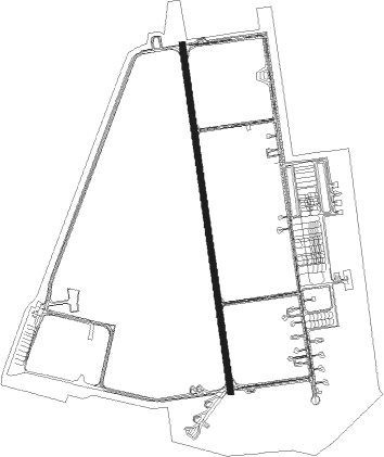
Taichung City - Taichung Cingcyuangang
Airport details
| Country | Taiwan |
| State | Taichung (city) |
| Region | RC |
| Airspace | Taipei Ctr |
| Municipality | Taichung |
| Elevation | 663ft (202m) |
| Timezone | GMT +8 |
| Coordinates | 24.26500, 120.62083 |
| Magnetic var | |
| Type | land |
| Available since | X-Plane v10.40 |
| ICAO code | RCMQ |
| IATA code | RMQ |
| FAA code | n/a |
Communication
| Taichung Cingcyuangang Cingcyuangang ATIS | 127.750 |
| Taichung Cingcyuangang CCK GROUND | 120.250 |
| Taichung Cingcyuangang CCK Tower | 118.750 |
| Taichung Cingcyuangang TAIPEI Approach | 131.850 |
Approach frequencies
| ILS-cat-I | RW36 | 111.5 | 18.00mi |
| ILS-cat-I | RW18 | 111.7 | 18.00mi |
| 3° GS | RW36 | 111.5 | 18.00mi |
| 3° GS | RW18 | 111.7 | 18.00mi |
Nearby Points of Interest:
Qingshui Military Community Culture Park
-Lin Family Mansion, Shekou
-Dajia Wenchang Temple
-Beitun Wenchang Temple
-Huangxi Academy
-Former National Taichung Library
-The Martial Arts Compound of the Taichung Criminal Law Enforcement Office
-Wufeng Lin Family Mansion and Garden
-Fangou Shrine
-Lantian Academy, Taiwan
-Tianmei Yonghe Temple
-the Tomb of Zheng Yong-xi
Nearby beacons
| code | identifier | dist | bearing | frequency |
|---|---|---|---|---|
| CCK | CINGCYUANGANG TACAN | 0.2 | 232° | 111.30 |
| TC | CINGCYUANGANG (TAICHUNG) NDB | 0.6 | 191° | 210 |
| TCK | (TAICHUNG) DME | 0.6 | 190° | 108.40 |
| WK | HSINSHIE NDB | 11.2 | 99° | 340 |
| HLG | HOULONG VOR/DME | 18.6 | 20° | 114 |
| HL | HOULONG NDB | 18.9 | 20° | 362 |
| HSU | HSINCHU TACAN | 37.6 | 30° | 116.30 |
| KU | CHIAYI NDB | 42.8 | 199° | 525 |
| RA | LUNGTANG NDB | 49.7 | 47° | 202 |
| HW | HUALIEN NDB | 55.7 | 116° | 280 |
| TYN | TAOYUAN TACAN | 58.7 | 38° | 115.80 |
| BM | MAGONG NDB | 67.3 | 236° | 290 |
| MKG | MAGONG (PENGHU I.) VOR/DME | 67.3 | 236° | 115.20 |
| SG | SONGSHAN (TAIPEI) NDB | 69.2 | 48° | 310 |
| TSI | SONGSHAN (TAIPEI) VOR/DME | 70.5 | 50° | 113.50 |
| AP | ANBU NDB | 73.5 | 45° | 250 |
| APU | ANBU (TAIPEI) VOR/DME | 73.6 | 45° | 112.50 |
Departure and arrival routes
| Transition altitude | 11000ft |
| Transition level | 13000ft |
| SID end points | distance | outbound heading | |
|---|---|---|---|
| RW18 | |||
| HLG1A | 19mi | 20° | |
| TENL1A | 22mi | 201° | |
| MODY1A | 67mi | 236° | |
| HOME1A | 14mi | 264° | |
| RW36 | |||
| HLG1B | 19mi | 20° | |
| TENL1B | 22mi | 201° | |
| MODY1B | 67mi | 236° | |
| HOME1B | 14mi | 264° | |
Instrument approach procedures
| runway | airway (heading) | route (dist, bearing) |
|---|---|---|
| RW18 | SARAR (148°) | SARAR 5000ft PATMI (6mi, 87°) 3800ft |
| RW18 | TELUS (176°) | TELUS 5000ft PATMI (6mi, 176°) 3800ft |
| RNAV | PATMI 3800ft KANGA (6mi, 176°) 2300ft RCMQ (6mi, 176°) 703ft (7067mi, 259°) 2000ft SARAR (7058mi, 79°) 5000ft SARAR (turn) 5000ft | |
| RW36 | BASIR (356°) | BASIR 5000ft PIKAT (6mi, 356°) 3800ft |
| RW36 | KADET (25°) | KADET 5000ft PIKAT (6mi, 87°) 3800ft |
| RNAV | PIKAT 3800ft MIDEL (6mi, 356°) 2300ft RCMQ (6mi, 356°) 713ft (7067mi, 259°) 1500ft KADET (7065mi, 79°) 5000ft KADET (turn) 5000ft |
Disclaimer
The information on this website is not for real aviation. Use this data with the X-Plane flight simulator only! Data taken with kind consent from X-Plane 12 source code and data files. Content is subject to change without notice.