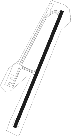
Beigan Island - Matsu Beigan
Airport details
| Country | Taiwan |
| State | Lienchiang County |
| Region | RC |
| Airspace | Shanghai Ctr |
| Municipality | Beigan |
| Elevation | 41ft (12m) |
| Timezone | GMT +8 |
| Coordinates | 26.22406, 120.00042 |
| Magnetic var | |
| Type | land |
| Available since | X-Plane v10.40 |
| ICAO code | RCMT |
| IATA code | MFK |
| FAA code | n/a |
Communication
| Matsu Beigan BEIGAN AIRPORT | 127.350 |
| Matsu Beigan BEIGAN TOWER | 118.650 |
| Matsu Beigan BEIGAN TOWER | 121.500 |
| Matsu Beigan TAIPEI CONTROL | 125.500 |
Approach frequencies
| LDA | RW21 | 109.5 | 18.00mi |
| LDA | RW03 | 109.5 | 18.00mi |
Nearby Points of Interest:
Luoxing Pagoda
-Yongquan Temple
-Linyang Temple
Nearby beacons
| code | identifier | dist | bearing | frequency |
|---|---|---|---|---|
| PK | MATSU NDB | 0 | 306° | 275 |
| PKN | DME-ILS | 0 | 293° | 109.70 |
| MT | MATSU NDB | 2.1 | 234° | 210 |
| MTS | DME | 2.1 | 234° | 112.70 |
| NKN | DME-ILS | 4.5 | 214° | 110.10 |
| NK | NANGAN (MATSU) NDB | 4.7 | 213° | 315 |
| N | FUZHOU NDB | 23.6 | 231° | 229 |
| LJG | LIANJIANG VOR/DME | 24.3 | 269° | 117.60 |
| FOC | FUZHOU VOR/DME | 24.7 | 230° | 116.80 |
| FQG | FUQING VOR/DME | 44.1 | 232° | 117.40 |
Departure and arrival routes
| Transition altitude | 11000ft |
| Transition level | 13000ft |
| SID end points | distance | outbound heading | |
|---|---|---|---|
| RW03 | |||
| LOTA1A | 25mi | 101° | |
| RALT1A | 27mi | 132° | |
| RW21 | |||
| LOTA1B | 25mi | 101° | |
| RALT1B | 27mi | 132° | |
Instrument approach procedures
| runway | airway (heading) | route (dist, bearing) |
|---|---|---|
| RW03 | MT033 (2°) | MT033 3000ft MT032 (5mi, 296°) 2000ft |
| RNAV | MT032 2000ft MT031 (5mi, 31°) 1400ft RCMT (5mi, 29°) 76ft RCMT (turn) 1300ft MT033 (11mi, 182°) 3000ft MT033 (turn) 3000ft |
Disclaimer
The information on this website is not for real aviation. Use this data with the X-Plane flight simulator only! Data taken with kind consent from X-Plane 12 source code and data files. Content is subject to change without notice.
