Omitama - Hyakuri
Airport details
| Country | Japan |
| State | Ibaraki Prefecture |
| Region | RJ |
| Airspace | Fukuoka Ctr |
| Municipality | Omitama |
| Elevation | 104ft (32m) |
| Timezone | GMT +9 |
| Coordinates | 36.18167, 140.41472 |
| Magnetic var | |
| Type | land |
| Available since | X-Plane v10.40 |
| ICAO code | RJAH |
| IATA code | IBR |
| FAA code | n/a |
Communication
| HYAKURI Ground Control | 119.500 |
| HYAKURI Tower | 126.200 |
| HYAKURI Approach | 120.100 |
| HYAKURI TCA | 124.800 |
| HYAKURI Departure | 120.100 |
Approach frequencies
| ILS-cat-I | RW03R | 109.3 | 18.00mi |
| 2.7° GS | RW03R | 109.3 | 18.00mi |
Nearby Points of Interest:
Hitachi Kokubunji
-Yokotone Lock
-historic streets of Sawara
-Seizansō
-Ryūgakuji Kofun Cluster
-Bernard Leach
-Kogane Ichirizuka
-Former Hananoi Family House
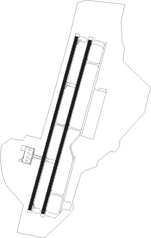
Runway info
Runway 03L / 21R  | ||
| length | 2703m (8868ft) | |
| bearing | 24° / 204° | |
| width | 45m (148ft) | |
| surface | asphalt | |
| blast zone | 255m (837ft) / 255m (837ft) | |
| Runway 03R / 21L | ||
| length | 2703m (8868ft) | |
| bearing | 24° / 204° | |
| width | 45m (148ft) | |
| surface | concrete | |
| blast zone | 255m (837ft) / 255m (837ft) | |
Nearby beacons
| code | identifier | dist | bearing | frequency |
|---|---|---|---|---|
| HUC | HYAKURI VORTAC | 0.3 | 349° | 113.30 |
| TLD | DME | 13.9 | 232° | 116 |
| NRE | NARITA (TOKYO) VOR/DME | 24.1 | 187° | 117.90 |
| SND | (TOKYO) DME | 25.7 | 240° | 114 |
| SYE | SEKIYADO VOR/DME | 29.7 | 253° | 117 |
| SHT | SHIMOFUSA (MATSUDO) TACAN | 30.1 | 227° | 108.20 |
| JD | NIKKO (UTSUNOMIYA) NDB | 32.3 | 299° | 389 |
| JDT | UTSUNOMIYA TACAN | 32.9 | 302° | 112.15 |
| CVT | CHOSHI TACAN | 33.1 | 140° | 113.60 |
| GOT | DAIGO TACAN | 33.9 | 353° | 115.30 |
| HME | HANEDA (TOKYO) VOR/DME | 48.9 | 227° | 112.20 |
| YLT | IRUMA TACAN | 52.7 | 251° | 110.60 |
| KZT | KISARAZU TACAN | 53.2 | 213° | 110.05 |
| OJT | ONJUKU TACAN | 59.9 | 182° | 115.70 |
| IXE | IWAKI VOR/DME | 64 | 30° | 117.70 |
| NJA | ATSUGI TACAN | 64.3 | 233° | 115.10 |
| HYD | DME | 68.7 | 222° | 116.20 |
Departure and arrival routes
| Transition altitude | 14000ft |
| Transition level | 14000ft |
| SID end points | distance | outbound heading | |
|---|---|---|---|
| RW03 (ALL) | |||
| HOKT5E, HOKTA5 | 139mi | 20° | |
| NAKAH4 | 32mi | 299° | |
| OGITU2 | 36mi | 354° | |
| RW03L | |||
| HITAK1 | 30mi | 29° | |
| RW21 (ALL) | |||
| HOKT5E, HOKTA5 | 139mi | 20° | |
| NAKAH4 | 32mi | 299° | |
| OGITU2 | 36mi | 354° | |
| RW21R | |||
| HITAK1 | 30mi | 29° | |
| STAR starting points | distance | inbound heading | |
|---|---|---|---|
| ALL | |||
| GOT | 33.9 | 173° | |
| TATSU | 30.5 | 198° | |
Instrument approach procedures
| runway | airway (heading) | route (dist, bearing) |
|---|---|---|
| RW03L | NAKAH (172°) | NAKAH H3L50 (16mi, 158°) TOMOE (4mi, 158°) MEGAT (6mi, 204°) SUMIG (5mi, 286°) 1300ft |
| RNAV | SUMIG 1300ft WAZKI (4mi, 24°) 1112ft H3L51 (2mi, 24°) 634ft RJAH (2mi, 26°) 157ft (7715mi, 256°) 610ft NAKAH (7705mi, 75°) 4000ft NAKAH (turn) 4000ft | |
| RW21R | NAKAH (172°) | NAKAH MAGRY (9mi, 144°) 3000ft |
| RNAV | MAGRY 2000ft OMITT (4mi, 204°) 1430ft H1R52 (2mi, 204°) 952ft RJAH (3mi, 203°) 157ft (7715mi, 256°) 610ft NAKAH (7705mi, 75°) 4000ft NAKAH (turn) 4000ft |
Disclaimer
The information on this website is not for real aviation. Use this data with the X-Plane flight simulator only! Data taken with kind consent from X-Plane 12 source code and data files. Content is subject to change without notice.